


81
Simulating Trail or Route Navigation
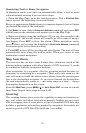
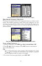
In Simulator mode, your unit can automatically follow a trail or route
without manual steering if you use these steps:
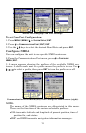
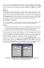
1. From the Map Page, go to the simulator menu. Pick a
STARTING POSI-
TION
at or near the beginning of your trail/route.
Enter an approximate
TRACK (shown in compass degrees) that will point
you toward the start of the trail/route.
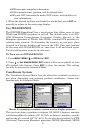
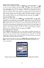
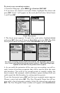
2. Set
SPEED to zero. Select STEER WITH ARROWS command and press ENT,
which turns on the simulator and returns you to the Map Page.
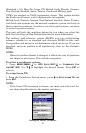
3. Begin navigating along the trail/route. (If you are close enough to the
first waypoint, the arrival alarm will usually go off as soon as naviga-
tion begins. Press
EXIT to clear the alarm.) When navigation starts,
press ↑ (since you're using the Simulator's
STEER WITH ARROWS command)
to increase speed to the desired setting.
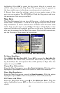
4. Press
EXIT to turn off the steering and speed boxes. The unit will now
automatically steer along the trail or route. When you arrive at your
destination, cancel navigation.
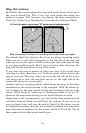
Map Auto Zoom
This receiver has an auto zoom feature that eliminates much of the
button pushing common with other brands of GPS receivers. It works
in conjunction with the navigation features.
Start navigation to a waypoint. (See the waypoint section for more in-
formation on navigating to a waypoint.) Then, with auto zoom on, the
unit will zoom out until the entire course shows, from the present posi-
tion to the destination waypoint. As you travel toward the destination,
the unit automatically zooms in — one zoom range at a time — always
keeping the destination on the screen.
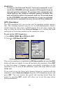
From the
MAP PAGE, press MENU|↓ to AUTO ZOOM|ENT to turn on (check)
Auto Zoom. Repeat these steps to turn it off.
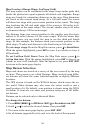
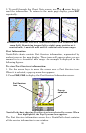
Scouting
The scouting feature gives users the capability to map out hunting ar-
eas, real estate and other land where property borders are not avail-
able in mapping data A scout plot is a type of recordable GPS data that
includes a perimeter or boundary marked by waypoints. Scout plots are
saved as part of a GPS Data File (with the *.usr suffix).