GPSMAP 4000 Series Owner’s Manual 13
uSInG chartS
usInG
charts
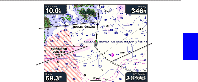
Heading line
Track
Chart
border
Heading Line—draws an extension from the bow of the boat in the direction of travel.
Off—turns off the heading line.
Distance—sets the distance to the end of the heading line.
Time—sets the amount of time until you reach the end of the heading line.
Chart Borders
—turn on chart borders if you are using a BlueChart g2 Vision SD card and
you want to see what area the maps cover.
Tracks—hides (off) or shows (on) tracks on the chart.
Appearance—customizes how items are shown on the map.
Changing the Chart Appearance
From the Home screen, select Charts > Chart Setup > Appearance, or press MENU while
viewing the navigation chart and select Chart Setup > Appearance.
Detail—adjusts the amount of detail shown on the map at different zoom levels. The Most setting
will show the most detail at higher zoom levels, but the maps may take longer to draw. The Least
setting will not show map details until the lower zoom levels.
Photos—sets the high resolution satellite images to on, off, or land only. High-resolution satellite
imagery is only available while using a BlueChart g2 Vision SD card. See page 14 for more
information.
Spot Depths—turns on spot soundings and set a dangerous depth.
Light Sectors
—adjusts the drawing of light sectors on the map.
Symbols—selects the navaid symbol set (NOAA or IALA).
Symbol Size—adjusts the size of the symbols shown on the map.
•
•
•
•


