


8 GPSMAP 4000 Series Owner’s Manual
uSInG chartS
usInG
charts
Navigation Chart Settings
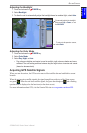
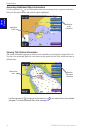
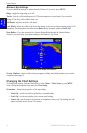
To access additional settings or options for the navigation chart, press MENU.
Weather—turns the NEXRAD weather overlay on or off. This choice is only available when a
Garmin XM Network device is connected. See page 53 for more information.
Overlay Numbers—control how important numbers appear on the screen. Choose to show or hide
different numbers by category. Select Auto to show navigation, shing, and sailing numbers. When a
category is set to Auto, those numbers will only appear when that category is active.
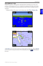
Cruising: GPS position, GPS heading, GPS speed, and depth (Depth is only available if
connected to a sonar unit.)
Navigation: GPS position, distance, arrival (time), bearing (to destination), GPS heading, and
GPS speed. These numbers appear only when navigating to a destination (see page 23).
Fishing: GPS position, depth, water temp, and water speed (Depth, temp, and water speed are
only available when connected to a capable sonar unit.)
Sailing: GPS position, waypoint velocity made good (VMG), wind speed, wind direction,
water speed, and depth. (Wind speed and direction are only available when connected to a
capable NMEA 0183 wind sensor. Water speed and depth are only available when connected
to a capable sonar unit.) If you have a capable wind sensor, setting the sailing overlay
numbers to Auto places an indicator around the boat icon on the navigation chart to represent
wind speed and direction.
Chart Setup—customizes the navigation chart. See page 12.
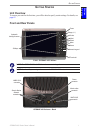
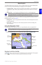
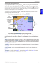
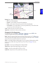
Understanding Chart Data
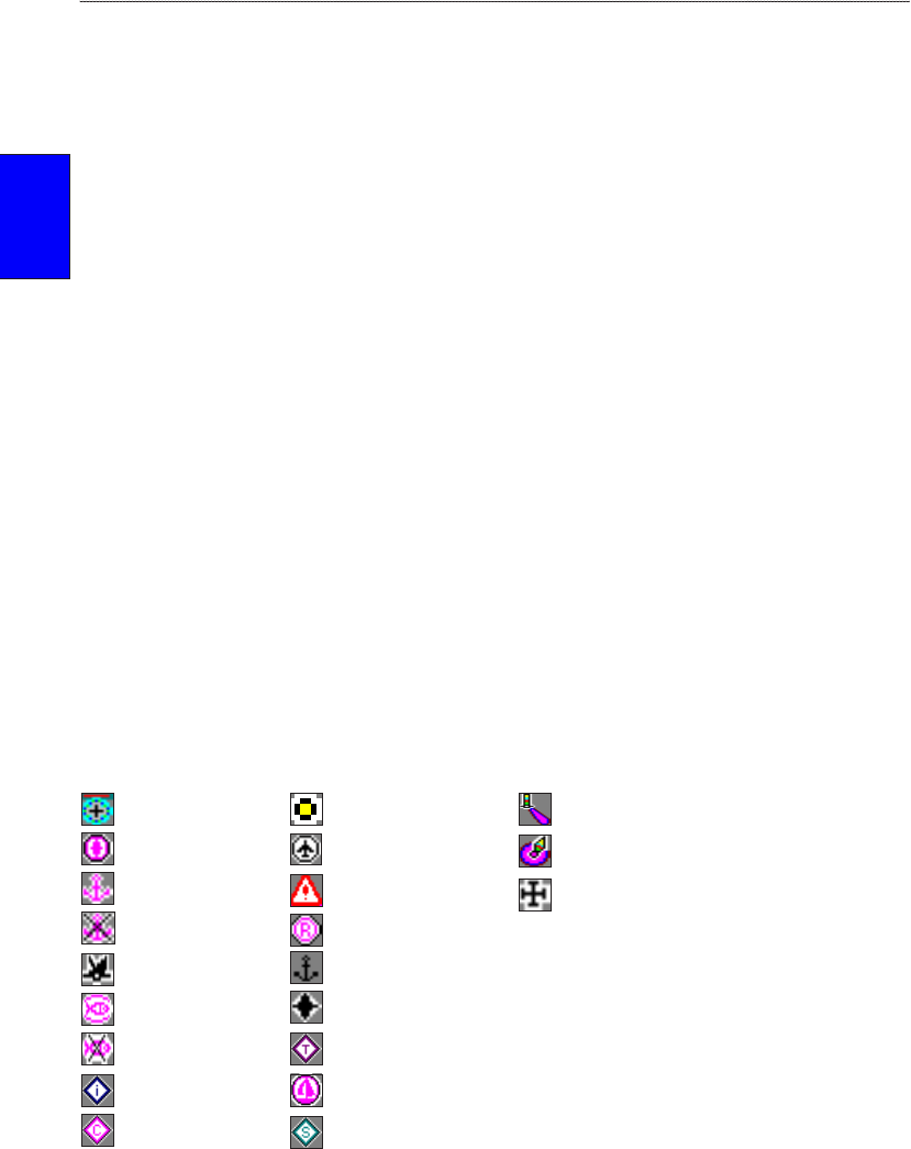
BlueChart g2 and BlueChart g2 Vision charts use graphic symbols to denote map features. Some
common symbols you might see include, but are not limited to, the following:*
Dangerous Rock Exposed Rock Beacon
Pilot Boarding Area Airport/Seaplane Base Buoy
Anchorage Berth Precautionary Area Church
Anchoring Prohibited Radio Report Point
Exposed Wreck Recommended Anchorage
Fishing Harbor Rescue Station
Fishing Prohibited Tide Station
Information Yacht Harbor
Current Station Marine Services
*Some symbols might appear differently on your Garmin unit.
Other features common to most charts include depth contour lines (with deep water represented in
white), intertidal zones, spot soundings (as depicted on the original paper chart), navigational aids
and symbols, and obstructions and cable areas.
•
•
•
•