


10 GPSMAP 4000 Series Owner’s Manual
uSInG chartS
usInG
charts
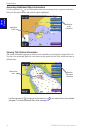
Accessing Additional Object Information
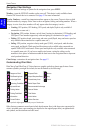
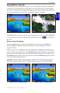
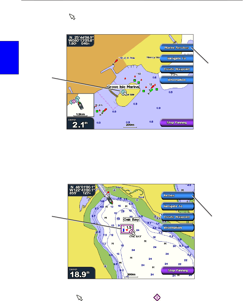
Use the map pointer ( ) to view information about on-screen map items, waypoints, and charts.
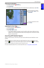
Select the rst option on the right with the object highlighted.
Object Selected on a GPSMAP 4208
Highlighted
object
Additional
object
information
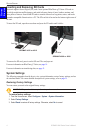
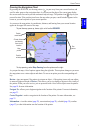
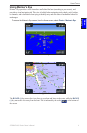
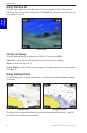
Viewing Tide Station Information
Tide station information appears on the chart with a detailed icon showing the relevant tide level.
You can view an in-depth graph for a tide station to help predict the tide level at different times or
different days.
Relevant tide
level
Detailed
tide station
information
Tide Station Selected on a GPSMAP 4208
Use the map pointer ( ) to highlight a tide station icon ( ), and select Review for a detailed
tide graph. For more information about tides, see page 29.