


GPSMAP 4000 Series Owner’s Manual 7
uSInG chartS
usInG
charts
usInG charts
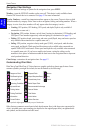
The GPSMAP 4008 and 4012 units have a basic worldwide imagery map, and the GPSMAP 4208
and 4212 have built-in detailed BlueChart g2 cartography for the US shoreline.
Navigation Chart—displays all relevant navigation data available on your preloaded maps,
including buoys, lights, cables, depth soundings, marinas, and tide stations in an overhead
view.
Mariner’s Eye—a view from above and behind your boat for a visual navigation aid.
NOTE: If you are using a GPSMAP 4008 or 4012, you must insert an optional BlueChart g2 Vision
preprogrammed SD card to view detailed Navigation and Mariner’s Eye charts.
Fishing Charts and Fish Eye 3D views are available when using optional Blue Chart® g2 Vision™
preprogrammed SD cards (See page 14).
Fishing Chart—removes navigational data from the chart, while enhancing bottom contours
for depth recognition.
Fish Eye 3D—an underwater view that visually represents the sea oor according to the
chart’s information.
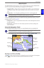
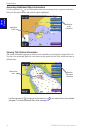
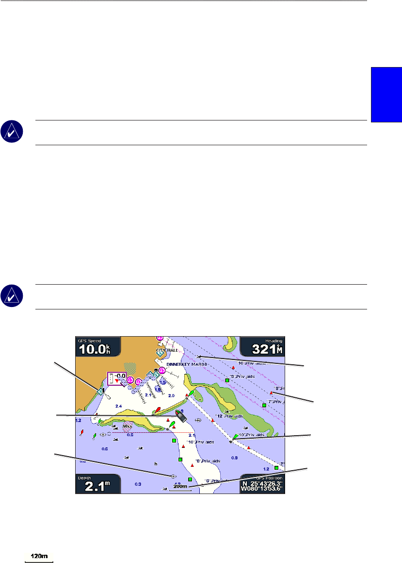
Using the Navigation Chart
Use the navigation chart to plan your course, view map information, and as a navigational aid.
NOTE: For GPSMAP 4008 or 4012 units, you must insert an optional BlueChart g2 Vision
preprogrammed SD card for your region to view detailed navigation charts.
To access a navigation chart, from the Home screen, select Charts > Navigation Chart.
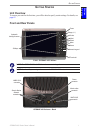
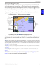
Navigation Chart on a GPSMAP 4208
Buoy
Beacon
Your boat
Exposed
wreck
Marine
services
Zoom scale
Submerged
wreck
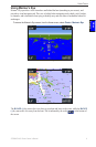
Zooming In and Out on the Map
The Range (+/-) keys control the zoom level, indicated by the scale at the bottom of the navigation
chart ( ). The bar under the number represents that distance on the map.
•
•
•
•