


54
eTrex Vista C
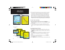
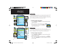
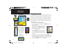
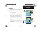
The Highway Page
GPS Navigation
The Highway Page
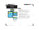
When you are navigating a route, the Highway Page can guide you to
the destination using data fields and a graphic highway. Up to four user-
selectable data fields display information such as speed, distance, time to
next point on the route, etc. The list of data to display and the method of
selection is the same as for the Compass Page and is explained in detail
on page 19.
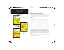
The Highway graphic provides visual guidance, taking you point by
point to your final destination. Your course is represented by a center
line down the middle of the graphic. As you move toward each point on
your route, the graphic shows the direction you should move to stay on
course to the point. Five scale settings allow you to zoom in or out on the
highway.
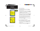
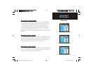
To navigate using the Highway Page:
1. While navigating, access the Highway Page from the Main
Menu and observe your path of travel displayed on the highway
graphic.
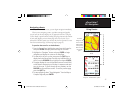
2. Press the MENU key to display the options menu. You can do
the following:
Stop Navigation/Resume Navigation, Recalculate, Confi gure
Data Fields from four to three with a destination guidance
message, Change the Data Fields or restore Defaults to factory
settings.
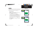
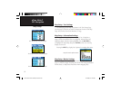
Highway Page
Options Menu
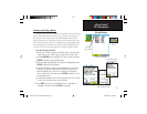
Highway Page with an
Active Route
Data Field
Display Options
eTrex Vista C Owner's Manual Text.indd 54 8/12/2004, 9:17:27 AM