


47
eTrex Vista C
GPS Navigation
Using Tracks
Track Profiles
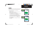
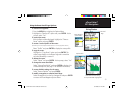
A Track Elevation Profile can be created from any saved track. A Track
Profile page displays when you select “Profile.” Digital Elevation Models
(DEM) maps can also be used to create track profiles. See page 86 for
more information about MapSource U.S. Topo 24K maps.
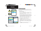
T
o view a Track Profi le:
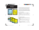
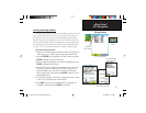
1.
With the Saved Tracks Page for the Track displayed, press the
MENU key to display the Profi le option.
2. Then press ENTER to display the Track Profi le.
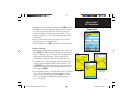
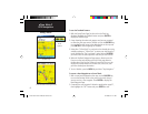
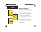
The beginning of the track is marked by a fl ag and you can scroll
across the profi le by pressing the left ROCKER key arrow.
As you scroll the profi le, the elevation for each point on the
profi le is displayed at the top of the page and the distance from
the Start point and the End Point is displayed at the bottom.
3. At any point along the profi le, you can press ENTER to display
that point on the map.
4. Press the MENU key to use “Zoom Ranges” and “Hide Sym-
bols” options.
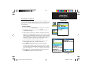
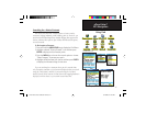
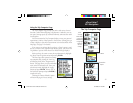
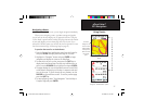
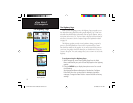
Zoom Ranges Page
View Profi le
Page Option
Track Profi le Page
eTrex Vista C Owner's Manual Text.indd 47 8/12/2004, 9:17:15 AM