


30
Reference
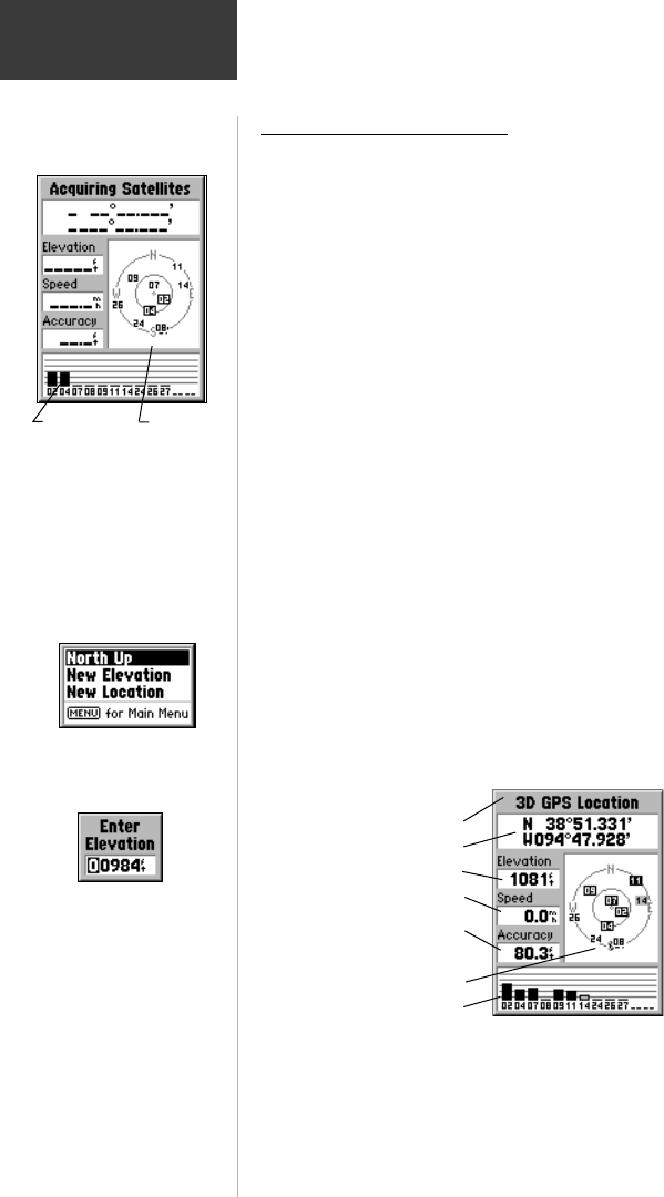
GPS Info Page
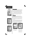
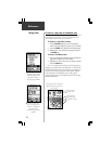
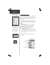
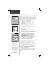
The GPS Information Page
acquiring satellites. Hollow bars
indicate satellites being
acquired. Solid bars indicate
acquired satellites and are
identified by the highlighted
numbers in the skyview.
GPS Status Page Options
Elevation Entry Field
Status Bars Skyview
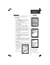
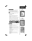
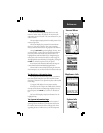
The GPS Information Page
The GPS Information Page provides a visual reference
of various receiver functions. As the receiver locks onto
satellites, a signal strength bar will appear for each satellite
in view, with the appropriate satellite number (01-32)
underneath.
When you first turn the unit on, the page title will be
“Acquiring Satellites”. After it has determined your location
the title will be “2D GPS Location” or “3D GPS Location”.
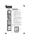
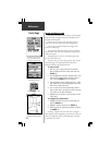
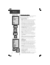
Options
North Up/Track Up - You can set the GPS Informa-
tion Page skyview orientation to either ‘North Up’ with
the skyview oriented north or ‘Track Up’ with the sky-
view oriented toward your current direction of travel.
These settings affect only the satellite skyview.
Elevation and Location - You can set a new elevation
and new location to help the eMap obtain a position fix.
These two options will not be available if your location
has been determined.
If the GPS receiver is turned off, the page title will be
“Simulating GPS”.
GPS Information Page
Receiver Status
Location Coordinates
Elevation
Speed
Accuracy
Skyview
Signal Strength Bars