


16
Reference
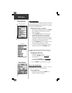
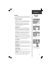
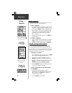
Measure Distance
The ‘Measure Distance’ option allows you to view the
distance and direction from your current location to another
location on the map or from one map location to another.
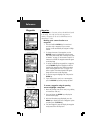
To use the ‘Measure Distance’ feature:
1. With the Map page displayed, highlight and select
‘Measure Distance’ from the list of options.
2. Press the ENTER key. A field for distance will appear
at the top of the map.
3. Move the panning arrow to the location you want to
measure from and press the ENTER key.
4. Move the panning arrow to the location you want to
measure to and the distance information will be
displayed in the field.
5. Press the ESCAPE key to exit this feature.
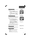
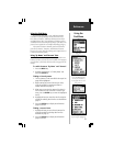
Map Page
Options
You can display the distance
and direction between two
locations on the map.
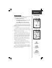
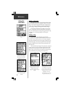
Stop Navigation
The ‘Stop Navigation’ option stops any active Route,
Goto or Track navigation. The option will appear gray and
cannot be selected if there is no active navigation.
When activated, the ‘Stop Navigation’ option will be
replaced by a ‘Resume Navigation’ option.
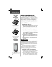
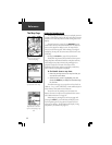
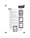
‘Show Next Street’ display.
‘Show Next Street’ option
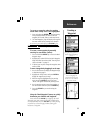
Show Next Street
The ‘Show Next Street’ option allows you to see the
name of the next street or interstate exit you are approach-
ing while traveling.
When ‘Show Next Street’ is highlighted and activated, a
field to display the next street information will appear at
the top of the map. The option list will then display ‘Hide Next
Street’.
The next street name will be displayed only if the
eMap is “matching” your position to roads on the map and
there is a nearby street.
The next interstate exit will be displayed only if you are
traveling on an interstate highway.
The field which displays the ‘Next Street’ information is
not present when a full screen map is used.