


17
Reference
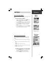
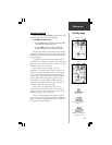
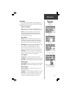
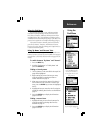
The Map Setup Pages allow
you to customize map details.
Map Page
Options
Setup Map
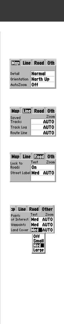
The Setup Map Option displays the Map Setup Pages. Map
Setup pages determine how the map is displayed, allowing you
to custom tailor the map display.
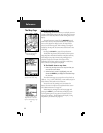
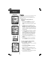
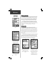
Common Settings
Text - Specifies the text size for a displayed map item.
Selecting ‘None’ will turn off the text display for that item.
Zoom - Specifies the maximum map scale at which a
map item will be displayed. If ‘Auto’ is selected, the
maximum map scale will be determined by the ‘Detail’
setting to prevent map clutter.
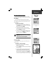
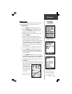
Map Options
Detail - Adjusts the amount of map information, such
as roads, that is displayed. ‘Most’ shows maximum
detail and ‘Least’ shows minimum detail. The higher
level of detail, the slower the map redrawing time.
Orientation - Selecting ‘North Up’ will display the map
with North at the top. Selecting ‘Track Up’ will
automatically rotate the map to keep your current
direction of travel at the top of the screen. The map
displays a ‘North’ indicator when in the ‘Track Up’ mode.
AutoZoom - When ‘On’, this option will automatically
adjust the map scale to show both your current location
and the next item to which you are navigating.
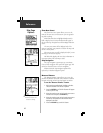
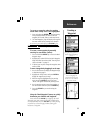
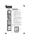
Line Options
Saved Tracks - Controls the display of Saved Tracks.
Track Log - Controls the display of the ‘Track Log’ on the map.
Route Line - Controls the display of the Route Line on the map.
Road Options
Lock to Roads - Places the Position Icon on the nearest road.
Street Label - Controls text size and displays at a set scale.
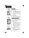
Other Options
Points of Interest - Controls the display of points of
interest on the map.
Waypoints - Controls the display of waypoints on the map.
Land Cover - Controls the display of land cover such
as swamps, etc. on the map. Land cover data is found
primarily on Topographical MapSource map data.
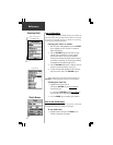
Map Options
Line Options
Other Map Item Options
Road Options