


5
Getting Started
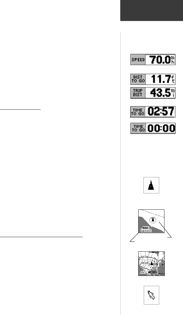
Speed, Distance and Time Fields
Speed - Your rate of travel can be displayed in miles
per hour, kilometers per hour, or nautical miles per hour.
Distance - When traveling on a Goto, Track or Route
the distance remaining to go to a destination will be
displayed. When not on a Goto, Track or Route, the
accumulated Trip Distance will be displayed.
Time - When on a Goto, Track or Route, the time to go
before reaching a destination is displayed. When not on
a Goto, Track or Route, the time for the current time
zone is displayed in either 12 or 24 hour format.
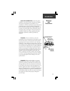
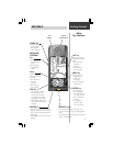
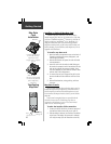
The Map Display
The map display shows your present position and
direction of movement as a triangular ‘Position Icon’ in the
center of the map. As you travel, the map display leaves a
“trail” (track log) of where you’ve been. The map display also
shows the map scale and geographic details such as lakes,
rivers, highways, and towns.
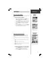
Use the IN and OUT keys to change the map scale to
show more map area with less detail, or less map area with
more detail. Press and hold to zoom the map scale rapidly.
In many instances the map will display an ‘Accuracy
Circle’ surrounding the ‘Position Icon’. The eMap uses both
map resolution and GPS accuracy in defining your location to
a point within the circle. The smaller the circle, the more
accurate your location.
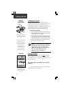
More detailed map features as well as information about
those features can be displayed using a data card containing
map data transferred from a GARMIN MapSource
CD-ROM.
When using MapSource data, the word “MapSource” will appear
below the map scale whenever you zoom in to view map details.
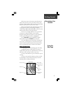
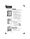
The Panning Arrow (Map Pointer)
The Panning Arrow is controlled by the ROCKER
keypad and is used to identify map objects and move the map
in order to view areas of the map not currently within the
display. The Panning Arrow can be used to establish a ‘Point of
Reference’ when measuring distance between map items. It can
be used to create a waypoint or to move a waypoint to a new
location. Refer to pages 14, 16, 18, and 19 for detailed
information about these applications.
Press the ROCKER keypad at an angle to move diagonally.
Press and hold the ROCKER keypad to move to new areas of
the map. Press the ESCAPE key to cancel the panning arrow.
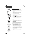
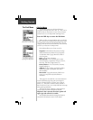
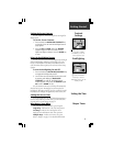
When counting down to
minutes and seconds the ‘Time
To Go’ Data Field will move
minutes to the former hour
position and display smaller
digits to indicate seconds.
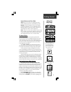
Position Icon
Using the
Map Page
Speed Data Field
‘Distance’ Data Fields
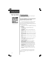
Zoom IN
Zoom OUT
Zooming Map Scales
Accuracy Circle
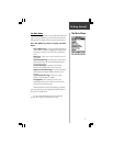
MapSource Indicator
‘Time To Go’ Data Field
Hours Minutes
Minutes Seconds
Panning Arrow