


19
4. ROUTES
In many cases a trip from one place to
another involves several course changes,
requiring a series of waypoints which you
navigate to, one after another. The sequence
of waypoints leading to the ultimate
destination is called a route. Your unit can
automatically advance to the next waypoint
on a route, so you do not have to change the
destination waypoint repeatedly.
4.1 Creating Routes
You can store up to 50 routes (numbered 01
to 50) and one LOG route, which is used to
temporarily store a route. A route may be
constructed four ways: by the cursor, by
waypoints entered from the waypoint list, by
waypoints entered from route menu, and by
storing current position automatically or
manually.
A route may contain 30 waypoints. When 30
waypoints have been saved, a message
informs you that you can no longer save
waypoints to the route. Press the [ENT] key
to erase the message and save the route,
under the name of the first and last waypoint
numbers used in the route.
Note: Be sure to record all important routes
in a separate log. This unit is not a fail-safe
record keeping device.
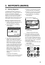
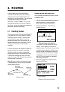
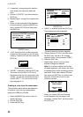
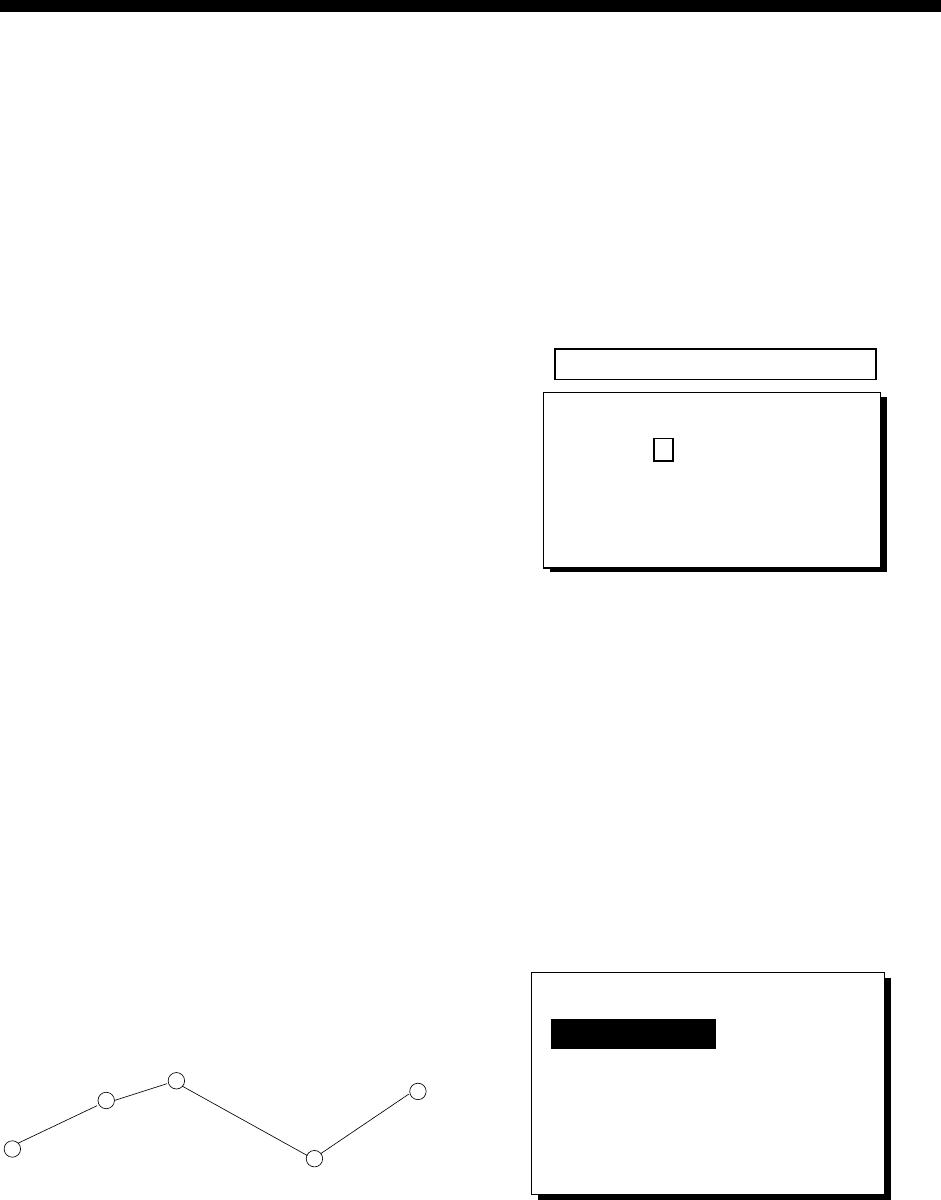
WAYPOINT
(Intermediate point)
WAYPOINT
(Arrival point)
WAYPOINT
(Intermediate point)
WAYPOINT
(Intermediate point)
WAYPOINT
(Starting point)
Sample route
Creating a route with the cursor
This is probably the easiest method by which
to create a route.
1. Use the cursor pad to place the cursor on
position desired. (Cursor position is
shown at the bottom of the screen.)
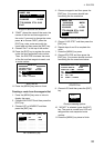
2. Press the [ENT] key. The following
window appears.
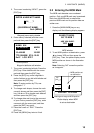
CURSOR POS. → WPT
ENTER A NEW WPT NAME.
0 0 1_ _ _?
(001:DEFAULT NAME)
QUIT: [MENU]
Waypoint name entry window
The cursor is on the second line of the
display. This is where you may enter
waypoint name. The number shown is the
youngest empty waypoint number. If you
want to register the waypoint under that
number, and you do not need to change
mark shape or enter a comment, press
the [ENT] key to register the waypoint,
and then go to step 5.
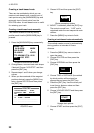
3. If desired, change the waypoint name.
Press the [ENT] key.
NAME: 004
34°39.836'N* MARK
135°12.059'E* x
10-JAN-02 10:25D
TTG 02H00M ETA: 12:25
Exit? LOG RTE?
* Current position
Waypoint attribute edit window