


90
Lock-to-Position: When GPS position is available, Uniden Navigation will automati-
cally keep moving the map to always have the blue (yellow at night) arrow, represent-
ing your actual position, on the screen. You can move the map to lose this position.
Then the Lock button appears on the screen. Tapping it will re-enable Lock-to-Posi-
tion. See also Page 30.
Map Orientation: Uniden Navigation is able to rotate the map for your convenience. If
you choose Track-up mode, the map will be rotated to look in the direction of your heading.
Selecting North-up, the map remains oriented to have North toward the top. Use the
left and right hardware buttons to turn your map in the direction you wish. This will
immediately turn off the automatic rotation. A small compass in the top right section
of the map screens (Page 32) will always show the current direction of the map. Map
orientation should not be mixed up with Screen orientation.
NMEA (National Marine Electronics Association): This is the name of a
communication protocol format. This association issues standards for interfacing
marine electronic devices. One of their standards is NMEA-0183 that denes
electrical signal requirements and a data transmission protocol for time and position
data. This is today’s standard for not only marine but also all other GPS devices.
Uniden Navigation, as well as most GPS devices, will default to using this protocol
out of the box.
North-up: A kind of map orientation having the map rotated to have North toward the
top of the screen. See also Track-up and Map Orientation.
POI: Points Of Interest, exact map locations of important points saved in a database
together with their name, category and subcategories (e.g. Service/Fuel/Autogas),
address, phone and fax number, and other important information. Use the versatile
search system in Uniden Navigation to nd the appropriate POI near you, your des-
tination or any other given location on the map (Page 81). You can also have your
favourite places saved as ‘My POI’ in Uniden Navigation.
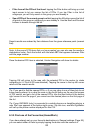
Screen Orientation: Depending on how you prefer to hold the PDA in your hand or
how you have it installed in your car, you may want Uniden Navigation to display all its
screens in a portrait, landscape, or left-handed landscape mode (Page ). This setting is
independent from the corresponding setting in the operating system. Screen rotation
in Uniden Navigation can even be used with PDAs originally not capable of displaying
landscape orientation. Screen orientation should not be mixed up with Map orienta-
tion that does not affect the appearance of Uniden Navigation, only the map itself.
SiRF: This is the name of a popular GPS chipset manufacturer. Their specic
communication protocol can be processed by Uniden Navigation. SiRF based GPS
devices are also capable of NMEA communication, the factory setting of communica-
tion protocol in Uniden Navigation.
Track log: In Uniden Navigation you have the possibility to record your journeys using
the position data your GPS provides in every second or every few seconds (depending
on your GPS settings). When you start the recording, position data are saved in the da-
tabase until you stop recording it. This set of sequential GPS positions is called track log.
Each set of consecutive positions has a name (originally it is the time of recording but
you can change it to any name you like) and a colour in which it can be displayed on the
map. Later you can replay the journey on the screen of Uniden Navigation as if it were
happening again. This is good for demonstration purposes or for analysing your
manoeuvres during the trip. See also Page 46.