


Reference
58
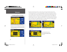
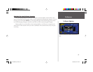
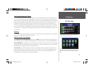
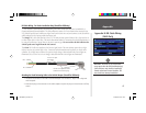
GPS Info Page
position fi x (indicated by 2D Navigation or 3D Navigation in the Satellite Status fi eld). You can also set the sky
view to a Track Up instead of North Up (default setting) orientation; this will cause the top of the sky view to
align to your current track heading.
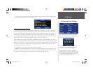
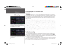
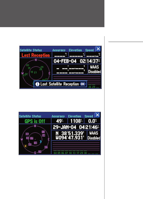
Satellite Status
As soon as the GPS receiver in your StreetPilot has collected the necessary data to calculate a fi x, the
status fi eld indicates a 2D or 3D status (for 2D, you may need to enter your elevation). Satellite Status is
indicated at the top left corner of the page. The status is shown as one of the following conditions:
Searching Sky – The GPS receiver is looking for any available satellites in view.
AutoLocate – The GPS receiver is initializing and collecting new almanac data. This process can take up to
fi ve minutes, depending on the satellites currently in view.
Acquiring Sats – The GPS receiver is collecting data from available satellites but has not collected enough
data to calculate a position fi x.
2D Navigation – At least three satellites with good geometry have been locked onto; a two-dimensional
position fi x (latitude and longitude) is being calculated. (Reads 2D Diff Nav if WAAS-enabled)
3D Navigation – At least four satellites with good geometry have been locked onto; your position is now
being calculated in latitude, longitude, and elevation. (Reads 3D Diff Nav if WAAS-enabled)
Lost Reception – The GPS receiver has temporarily lost satellite reception.
Poor GPS Coverage – The GPS receiver isn’t tracking enough satellites for a 2D or 3D fi x due to bad satel-
lite geometry or due to a shaded antenna (such as driving between buildings)
Not Usable – The StreetPilot is unusable, possibly due to incorrect initialization or abnormal satellite condi-
tions. Turn the unit off and back on to reset and re-initialize the receiver if necessary.
GPS is Off – The StreetPilot is being used indoors and cannot be used for navigation.
Dead Reckoning (2660 only) – The StreetPilot 2660 isn’t tracking enough satellites for a 2D or 3D fi x
due to bad satellite geometry or a shaded antenna (such as driving between buildings), and is using Dead
Reckoning.
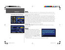
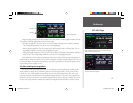
The sun and moon icons on the satellite sky view are
for reference (note that the icons are a bluish color if
the sun/moon is below the horizon). You can see the
sunrise and sunset times for your current location and
date on the Time Setup page under System Setup.
You can temporarily lose satellite reception if no satel-
lite information is received for a few minutes, or if the
number of satellites received to determine a position fi x
is insuffi cient.
190-00342-00_0A.indd 58 4/13/2004, 9:57:22 AM