


Reference
25
When you fi nd the name of the waypoint you seek (no matter which search method you used), touch
the waypoint name and a Waypoint Review page will appear, displaying the longitude and latitude coordi-
nates of the waypoint. Touch Show Map if you want to see the waypoint on the Map page, or Go To if you
want your StreetPilot to navigate to the waypoint. Touch Delete if you want to remove this waypoint from
your StreetPilot’s memory.
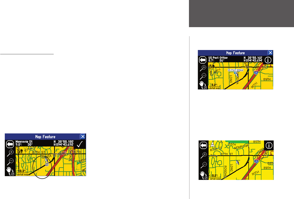
Advanced Find Features
Main Map Feature: As was discussed above, you can view a selected location (an eatery, a hotel,
waypoint, or city, for example) on the Map page when you select Show Map. The Map page will include
additional information such as current coordinates, current location name, and miles from your current
position (see the examples in the right-hand column on this page). If you would like to see the location on
a cleaner Map page, press the unit’s MENU key and then select the Locate on Main Map icon. All extraneous
information will disappear.
Measuring Distance to a Place: When you select Show Map to view a place, city, and street you have
found on the Map page, you can also perform a straight-line measurement of that place to see the distance
from it to your current position or any other location. To view this measuring tool, press the unit’s MENU
key and then select the Measure Distance icon. A new Map page will appear, showing the place, city, or
street, with a line pointing back to your current physical location. See Measuring Distances Between Two
Places, page 36, for more information.
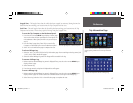
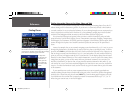
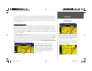
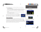
Finding Places
The type of view shown above appears when you select
Show Map for any feature/location you fi nd. On the left
side of the top bar, the name of the found feature (“US
Post Offi ce”) is displayed. It is 8.9 miles and 30º from
your current physical location. The right side of the top
bar displays the Post Offi ce’s coordinates.
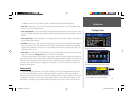
To view a cleaner display, press the unit MENU key and
select the Locate on Main Map icon. A view much like
the one shown below will appear.
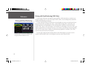
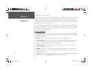
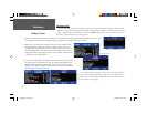
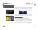
USING THE “SHOW MAP” FEATURE
Once you select a location through the Find feature,
select Show Map to display this new location on the
Map page. To activate the “measuring tool,” press the
MENU key and then select the Measure Distance icon.
You can then take straight-line measurements from the
new location to your current location or other places
you select. See page 36 for more information on using
the measuring tool.
190-00342-00_0A.indd 25 4/13/2004, 9:56:51 AM