


53
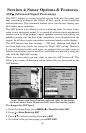
Other Free Training Aids
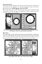
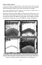
The sonar options section discusses Fish I.D., fish alarms and other
features in greater detail. If you or a friend has Internet access, you can
also learn more about interpreting what you see on your sonar screen.
Visit our web site, www.lowrance.com. Be sure to check out the free
Sonar Tutorial, which includes animated illustrations and more pic-
tures of actual sonar returns, all described in detail. There's even a
"printer friendly" version of the tutorial available on our web site…it
makes a great supplement to this operation manual!
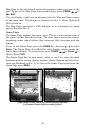
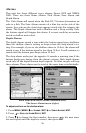
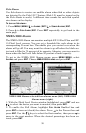
You can also download a free copy of our Sonar Viewer software. This
PC-based software application plays back any sonar chart log recorded
with a Lowrance sonar product. Features include:
• Adjustable range, zoom, sensitivity, color line, noise rejection,
surface clarity, etc. of the recorded file.
• Color interpretation of sonar signals can be user defined.
• Operates like a Windows Multimedia Player with forward, re-
verse, pause, fast forward, fast reverse, and scroll buttons.
• Adjustments update the entire record displayed.
• Can print in full color.
• Window can dynamically be sized on your monitor.
• Mouse cursor shows GPS position, depth and sounding number
anywhere on the visible record.
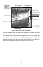
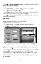
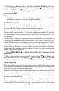
For the ultimate training aid, be sure to download the free emulator
software for your unit. Aside from being fun, this program can help you
learn both basic and advanced operations without burning boat fuel!
Lowrance is one of the first sonar manufacturers to provide this type of
training tool for customers.
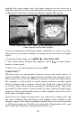
This PC application simulates the actual sonar/GPS unit on your com-
puter. You can run it from your computer keyboard or use your mouse
to press the virtual keys. Easy download and installation instructions
are available on our web site.
The emulator works exactly like your real sonar/GPS unit. Using the
Sonar Simulator and GPS Simulator features, it allows you to play
back sonar logs, run GPS routes and trails and create real waypoints
you can use in the field! You can even take snapshots of the Sonar
Chart and print them or e-mail them to friends.