


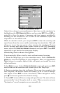
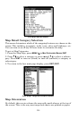

158
Port Services information.
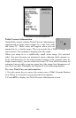
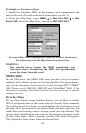
Tidal Current Information
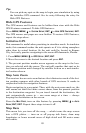
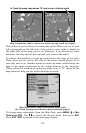
NauticPath charts contain Tidal Current information,
represented at large zoom ranges by a box icon with
the letter "C." These icons will appear when you are
zoomed in to a 6-mile range. The icon stands for a Tidal Current Sta-
tion location. An example is displayed on the right.
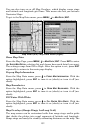
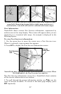
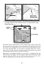
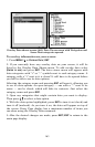
When you zoom in to a sufficiently small zoom range (0.8 nautical
mile), the icon becomes an animated arrow showing tidal current ve-
locity and direction for the selected tidal station at the present time. At
larger zoom ranges, you can select the boxed "C" icon and it becomes an
animated arrow with a pop-up name box (the name box disappears af-
ter a few seconds). Examples are displayed in the following figures.
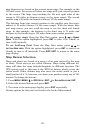
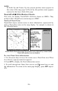
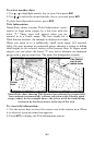
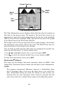
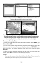
To view Tidal Current information:
1. Use the arrow keys to move the cursor over a Tidal Current Station
icon. When it is selected, a pop-up name box appears.
2. Press
WPT to display the Tidal Current Information screen.