


69
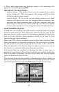
equivalent of WAAS. Like WAAS, it makes GPS position calculation
more accurate. To determine the accuracy in your area, place yourself
in a known location and turn on the GPS. Note your location on the
map with WAAS/EGNOS on, then turn it off and check again. Use the
setting that is most accurate in your area.
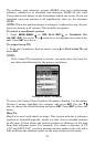
To Turn on or off WAAS/EGNOS:
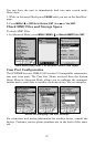
1. Press
MENU|MENU|↓ to GPS SETUP|ENT.
2. Press ↓ to
USE WAAS/EGNOS|ENT, which will turn on (check) or turn
off (uncheck
) the feature. Press EXIT to clear the menus. Note that this
setting can only be accessed in Advanced Mode.
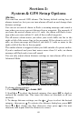
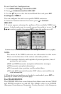
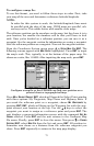
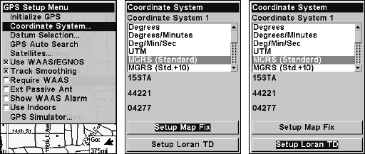
Coordinate System
The Coordinate System Menu lets you select the coordinate system to
use when displaying and entering position coordinates. Access this
function only in Advanced Mode.
Menus for changing coordinate system used to display positions.
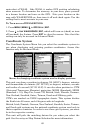
This unit can show a position in degrees (36.14952°); degrees, minutes
and thousandths of a minute (36° 28.700'); or degrees, minutes, seconds
and tenths of a second (36° 28' 40.9'). It can also show position in: UTM
(Universal Transverse Mercator) projection; MGRS (Standard); MGRS
(Standard + 10); Map Fix; Loran TD; British, Irish, Finnish, German,
New Zealand, Swedish, Swiss, Taiwan, Greek and Military grids.
UTM's are marked on USGS topographic charts. This system divides
the Earth into 60 zones, each 6 degrees wide in longitude.
British, Irish, Finnish, German, New Zealand, Swedish, Swiss, Taiwan,
and Greek grid systems are the national coordinate system used only in
their respective countries. In order to use these grid systems, you must
be in the respective country.
This unit will pick the matching datum for you when you select the
grid. See the entry on Map Datum Selection for more information.