


29
Find Your Current Position
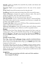
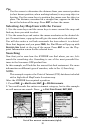
Finding your current position is as simple as turning on the iFINDER.
The unit automatically searches for satellites and under a clear sky,
calculates its position in approximately one minute or less.
NOTE:
Clear sky means open sky, unobstructed by terrain, dense foliage or
structures. Clouds do not restrict GPS signal reception.
If for some reason satellite acquisition takes longer, you may be inside
a structure, a vehicle or in terrain that is blocking signal reception. To
correct this, be sure you are positioned so the unit has as clear a view of
the sky as possible, then turn the unit off and back on again.
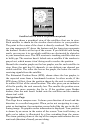
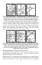
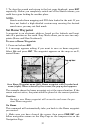
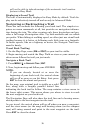
Moving Around the Map: Zoom & Cursor Arrow Keys
The map is presented from a bird's eye view. The current zoom range
shows in the lower left corner of the screen.
1. Press the
ZIN key (zoom in) to move in closer and see greater detail in
a smaller geographic area.
2. Press the
ZOUT key (zoom out) to move farther away and see less map
detail in a larger geographic area.
When you are walking or riding in a vehicle, the map will automatically
move as you move. This keeps your current location roughly centered
on the screen.
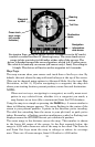
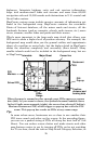
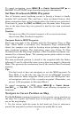
You can scroll the map northward, southward, eastward or westward
by using the arrow keys, which will launch the cursor crosshairs. This
allows you to look anywhere on the map. To clear the cursor, press
EXIT
and the map will revert to the current or last known position.
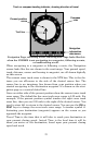
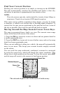
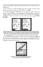
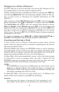
The selected airport to the northwest is 4.2 miles away.
Distance
measured
by cursor
Cursor line
Selected airport
Cursor line