


13
The family decides to hide the cache along a public trail approximately 10 miles from their home.
Before they can add the cache to geocaching.com, they must get a very accurate coordinate for the
location where they’re hiding the cache. To do so, they must mark a waypoint at the geocache location
and then use the Averaging function on the Earthmate GPS PN-20. When a waypoint is averaged, a
series of GPS readings for the waypoint’s location is recorded and averaged to increase the positional
accuracy of the waypoint.
1. Ensure you have a 3-D signal at the location of the geocache.
2. Press the Mark button. A waypoint is placed at the current GPS location.
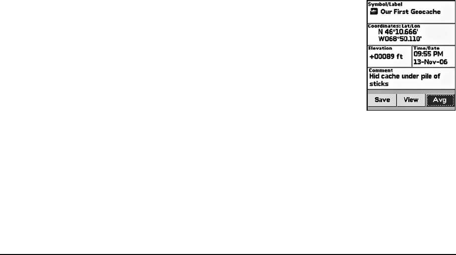
3. Highlight the default waypoint symbol and press ENTER. Use the arrow keypad to select
the geocache hidden symbol and press ENTER.
4. Highlight the default label and press ENTER. Enter the new label “Our First Geocache” using
the keyboard, highlight OK, and press ENTER.
5. Highlight the Comment field and press ENTER. Enter the comment information (“Hid cache
under pile of sticks”) using the keyboard, highlight OK, and press ENTER.
6. Highlight the Avg button and press ENTER. The GPS status, coordinates, elevation, number of
readings at the location, and estimated accuracy display. The positional accuracy of the way-
point is increased by the number of recordings. A small estimated accuracy number indicates
that the waypoint is very close to its actual coordinates.
7. Highlight the OK button and press ENTER.
8. Use the arrow keypad to highlight the Save button and then press ENTER.
Once the geocache location point is averaged, they visit www.geocaching.com and create a new
geocache with the averaged coordinate.
Bird Watching
TheEarthmateGPSPN-20isaperfectcompanionforbirdwatching.Withaerialimageryloadedonthe
EarthmateGPSPN-20,birdwatcherscanseeclearings,treecover,geologicalfeatures,andmore.In
addition,theycanusethewaypointfunctiontomarkwaypointsonthemapwhentheyseeparticular
typesofbirds.Theycanalsousethetrackfunctionalitytocreateabreadcrumbtrailwhilethey’retravel-
ingtotheirbirdwatchingspotandthenfollowthattrackbacktotheirvehiclesotheydonotgetlost.
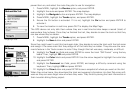
Scenarios
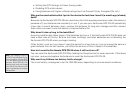
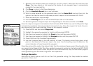
Markingthe“OurFirstGeo-
cache”waypoint