


Black plate (28,1)
Model "NAV2-N" EDITED: 2009/ 7/ 17
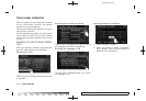
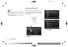
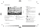
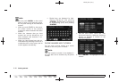
HOW TO VIEW MAP SCREEN
The navigation system displays various informa-
tion on the map screen.
Screen information
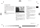
&
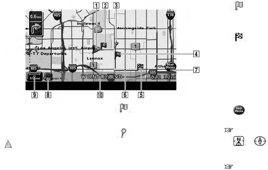
1
Vehicle icon:
Indicates the current vehicle location and
the direction that you are traveling.
&
2
Starting point:
Displays the vehicle location, with which the
route is set, as the starting point.
&
3
Guide point:
Indicates a guide point on the route.
&
4
Waypoint:
Displays the locations that you travel past
when going to the destination. A maximum
of 5 waypoints can be set.
&
5
Destination:
Indicates the destination location of the
route guidance.
When the map scale is 300 ft (100 m) or
less in Plan View, or 1/4 mile (500 m) or less
in Birdview
TM
: The name is displayed on the
map screen.
&
6
Suggested route:
Appears in bold yellow during route gui-
dance.
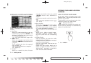
&
7
Map Menu icon:
Touch the icon to display the Map Menu
screen.
“MAP MENU SCREEN” (page 2-13)
&
8
/ Direction indicator:
Indicates the direction of the map.
Touch the icon to switch the direction of the
map.
“SETTINGS OF HEADING/LONG
RANGE MAP VIEW” (page 3-14)
OPERATING MAPS
2-20 Getting started