


Black plate (210,1)
Model "NAV2-N" EDITED: 2009/ 7/ 17
. There may be cases that carpool lanes are
included on a suggested route when the
automatic rerouting function is activated,
even if the “Use Time Restricted Roads” is
turned off.
“SETTING CONDITIONS FOR THE
ROUTE CALCULATION” (page 5-13)
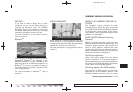
. The navigation system does not provide
route guidance for roads displayed in dark
green.
. If the destination is set on a dark green road,
the enlarged map display will switch to the
ordinary map screen at some point and
suggest a route that is near the destination.
The distance and direction to the endpoint
of the suggested route will be displayed in
the lower right corner of the screen. Also, at
this time, voice guidance will announce,
“The route to your destinat ion incl udes
roads through incomplete map areas. Voice
guidance will not be provided in these
areas”.
When approaching the endpoint of the
suggested route, voice guidance will an-
nounce, “Entering the road with incomplete
map data. Please use the direction arrow
and distance information to proceed to your
destination.”
To reach your destination, refer to the map
screen. Always follow actual roads and
regulations and drive safely.
. The suggested route may not be the short-
est, nor are other circumstances such as
traffic jams considered.
. Because of the inevitable difference in road
conditions and circumstances between the
time you use this system and the time the
information was produced for the map data,
there may be discrepancies in roads and
regulations. In such cases, follow the actual
information available.
. During route calculation, the map will not
scroll, however the vehicle icon will move
with the actual vehicle’s movement.
. During route calculation, buttons such as
<MAP>, <DEST>, <ZOOM OUT> and
<ZOOM IN> and the multi-function con-
troller will be disabled.
. In some cases, after the calculation is
complete, the calculated route may not be
immediately displayed.
. Waypoints that have been passed will be
disregarded by rerouting calculation.
. If you scroll the map while the suggested
route is being drawn, it may take more time
to finish drawing.
. If waypoints are set, the system calculates
multiple routes between waypoints simulta-
neously, and the following may result.
— If one section between waypoints cannot
be calculated, none of the route will be
displayed.
— The route may not connect completely at
some waypoints.
— The route may require a U-turn close to
some waypoints.
. Route calculation may not be completed in
the following cases.
— If there is no main road within a range of
1.5 miles (2.5 km) from the vehicle, a
message saying so will appear on the
screen. Try recalculating when the vehi-
cle is closer to a main road.
— If there is no main road within a range of
1.5 miles (2.5 km) from the destination or
waypoint, a message saying so will
appear on the screen. Try setting the
location closer to a main road.
— If the vehicle is too close to the
destination or if there are no roads to
the destination, a message saying so will
appear on the screen.
— If it is impossible to reach the destination
or waypoints because of traffic regula-
tions, etc.
— If the only route to reach the destination
or waypoints is extremely complicated.
ROUTE CALCULATION
10-8 General system information