


Astro
Dog Tracking System Owner’s Manual 49
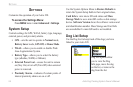
GpS appLIcatIonS
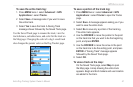
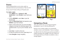
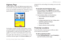
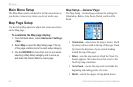
Highway Page
When navigating a route, the Highway page guides you to
the destination using data elds and a graphic highway. Up
to four user-selectable data elds show information such as
speed, distance, time to next point on the route, etc.
The Highway graphic provides visual guidance, taking
you point by point to your nal destination. Your course
is represented by a center line down the middle of the
graphic. As you move toward each point on your route,
the graphic shows the direction you should move to stay
on course to the next point. Use the In and Out keys to
change the ve scale settings for zooming in or out on the
highway.
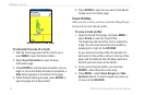
To navigate using the Highway page:
1. While navigating, select Highway from the GPS
Applications Menu, and observe your path of travel
displayed on the highway graphic.
2. Use the Options Menu to do the following:
Stop navigation/resume navigation
Recalculate
Congure data elds from four to three with a
destination guidance message
Change the data elds
Restore defaults to factory settings
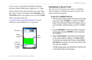
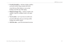
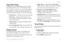
Proximity Locations
Use the Proximity Locations page to dene an alarm
circle around a stored location.
To add a proximity location
1. Access GPS Applications > select
Proximity to
open the Proximity Location page.
•
•
•
•
•