


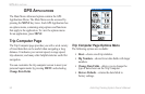


38 Astro Dog Tracking System Owner’s Manual
GpS appLIcatIonS
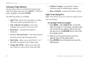
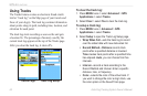
To adjust zoom ranges:
1. Select the type of plot you want to view, and use
the ROCKER to select Zoom Ranges on the
Options Menu.
2. Press ENTER to open the Zoom Ranges page.
Press up or down on the ROCKER to adjust the
vertical distance or pressure, and press left or right
to adjust either the time or distance.
OR
Pressing up or down on the ROCKER while a plot
is displayed, switches the screen to the Zoom
Range mode.
3. Press ENTER to return to the Plot page.
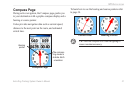
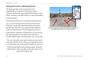
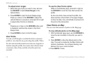
View Points
You can scroll through a recorded elevation or pressure
prole to view data for any point along the prole. When
the red vertical and horizontal cross hairs are stopped at a
location along the prole, the screen shows the elevation
or pressure, time of day, and date when the point was
recorded.
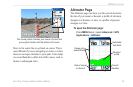
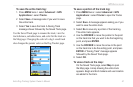
To use the View Points option:
While on the Altimeter page, press left or right on
the ROCKER to scroll the cross hairs across the
prole.
As the cross hairs move across the prole, the
status window at the bottom of the page changes
to show the date, time, and altitude or pressure for
the point at the intersection.
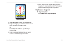
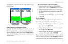
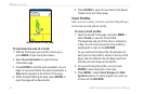
View Points on Map
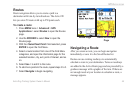
You can view the location of points on the Map page.
To view altitude points on the Map page:
1. With the Altimeter page open, use the ROCKER to
move the red crosshairs to the point you want to
view.
2. Press ENTER to show the altitude point on the
map. The point is marked by the Map Pointer with
location coordinates, the compass bearing, and
distance from your current location.
3. Press BACK to close.