


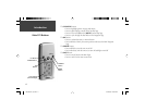
4
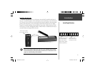
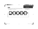
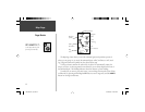
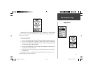
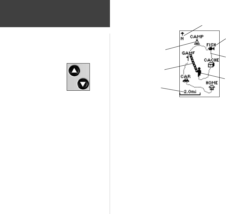
The Map Page shows where you are (the animated fi gure) and provides a picture of
where you are going. As you travel (the animated fi gure ‘walks’) and leaves a ‘trail’ (track
log). Waypoint names and symbols are also shown on the map.
To help you better visualize the ‘real world’, the Geko 201 automatically rotates the
map as you move, so that waypoints that are ahead of you are always displayed in front of
the animated fi gure. The Heading Indicator shows the direction you are heading.
To make sure you can see your entire route, you can change the map scale (from 50 feet
to 800 miles) by pressing and holding the UP Button to view a larger area, and the DOWN
Button for viewing a smaller area.
‘You’
(your location)
Heading Indicator
Path to
Destination
Map
Scale
‘Trail’
(track log)
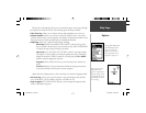
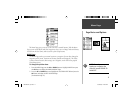
When on the Map Page, the
UP and DOWN Buttons are
used to adjust the map scale
from 50 feet to 800 miles.
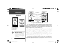
Map Page
Page Basics
Waypoint
Symbol
Waypoint
Name
190-00297-01_0C.indd 4 10/2/2003, 1:41:03 PM