


2
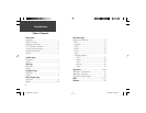
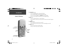
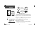
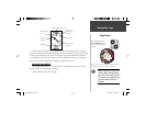
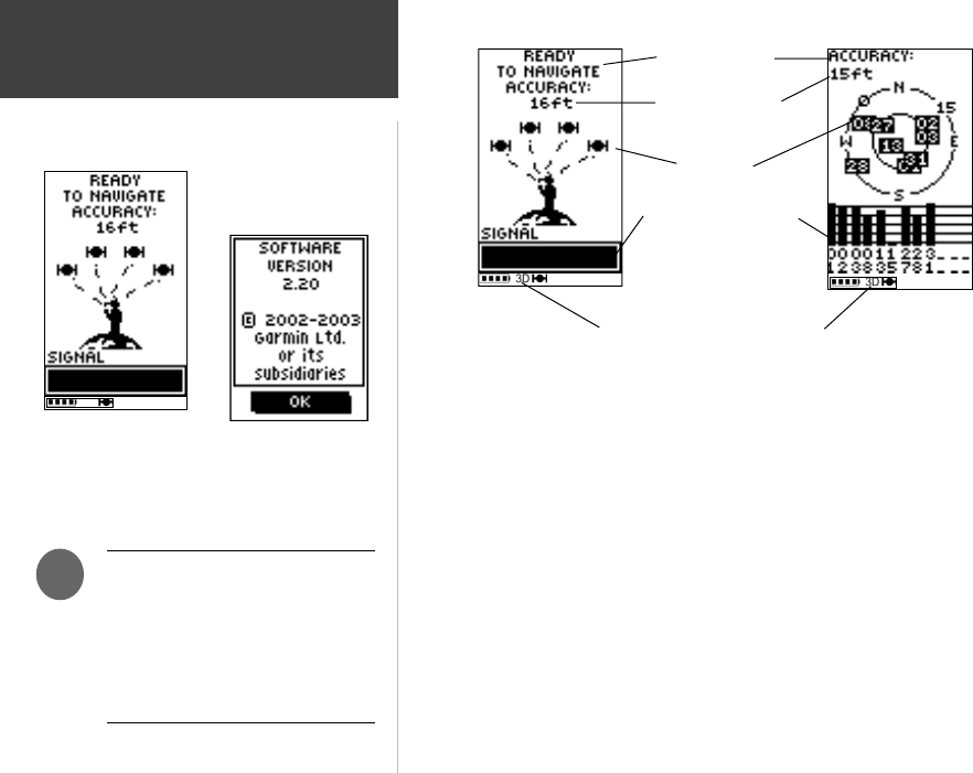
The Satellite Page shows the Geko 201 gathering all the necessary satellite information
in order to work. There are two display options on the Satellite Page, Normal Skyview and
Advanced Skyview. Normal Skyview shows you (in animation), the satellites, satellite signal
strength, and the Geko 201’s estimated location accuracy.
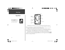
To activate the Advanced Skyview page, press the OK Button on the Satellite Page, select
‘Advanced Skyview’ and press the OK Button again. This page displays the numbered satel-
lites the Geko 201 is using, their proximity to your current position, and their individual
strengths. The outer circle of the display represents the horizon and the center represents
the sky directly overhead to help you determine the location of the satellites.
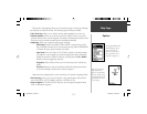
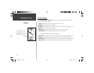
When you see the “READY TO NAVIGATE” message on the Satellite Page, the Geko 201
has found your location and you are ready to go!
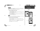
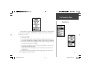
To see the software version that the Geko 201 is currently using, press the OK Button
on the Satellite Page and select ‘About Geko’. (A PC-compatible computer and Power/Data
cable, not included, are required to update the software.)
A “READY TO NAVIGATE”
message must display before
you can begin using your
Geko 201 to navigate.
Page Basics
Satellite Pages
NOTE: When you use the
Geko 201 for the fi rst time, allow
time for it to track satellites by
leaving the Geko 201 outside
with a clear view of the sky for
15-30 minutes.
)
Location Accuracy
(estimated)
Satellites
Satellite Signal Strength
Bars (a ‘D’ stands for
differential corrections
and denotes a WAAS
Satellite)
Status Message
The ‘3D’ displays when receiving
signals from four or more satellites.
Normal Skyview
Advanced Skyview
About Geko
190-00297-01_0C.indd 2 10/2/2003, 1:41:02 PM