


GPSMAP 60CSx Owner’s Manual 65
MAIn Menu > route PAge - hIghwAy PAge
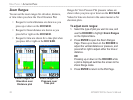
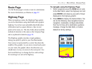
Route Page
Use the Routes page to create a route to a destination.
For more information, see Routes on page 32.
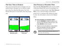
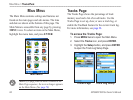
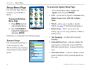
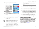
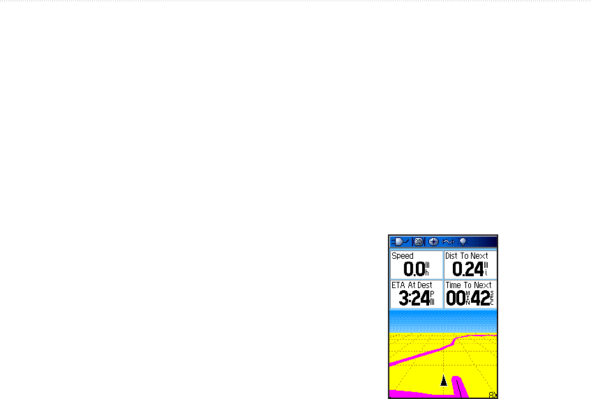
Highway Page
When navigating a route, the Highway Page guides
you to the destination using data elds and a graphic
highway. Up to four user-selectable data elds show
information such as speed, distance, time to next
point on the route, etc. The list of data shown and the
method of selection is the same as the Compass Page
and is explained in detail on page 54.
The Highway graphic provides visual guidance,
taking you point by point to your nal destination.
Your course is represented by a center line down the
middle of the graphic. As you move toward each point
on your route, the graphic shows the direction you
should move to stay on course to the next point. Use
the In and Out keys to change the ve scale settings
for zooming in or out on the highway.
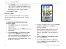
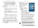
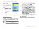
To navigate using the Highway Page:
1. While navigating, press the PAGE key to cycle
to the Main Menu, select the Highway icon and
press ENTER, and observe your path of travel
displayed on the highway graphic.
2. Press MENU to display the Options Menu. You
can do the following: stop navigation/resume
navigation, recalculate, congure data elds
from four to three with a destination guidance
message, change the data elds, or restore
defaults to factory settings.
Highway Page