


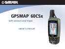


GPSMAP 60CSx Owner’s Manual iii
IntroductIon > tAble of contents
Finding an Address ................................................22
Finding an Intersection ..........................................24
Searching for a Point of Interest ............................24
POI Loader & Custom Points of Interest ...............25
Using Tracks ..................................................... 26
Track Proles .........................................................30
Navigating a Saved Track ......................................31
Creating and Using Routes ............................. 32
Creating a Route ....................................................32
Navigating a Route ........................................... 33
Editing a Route ......................................................34
Vertical Proles of routes ......................................36
Using the Route Page Options ...............................36
Main Pages ..................................................... 37
Satellite Page .................................................... 38
Using the Satellite Page Options Menu .................38
Using Additional Map Data ...................................40
Changing the Zoom Range ....................................41
Map Orientation .....................................................41
Map Page Options .................................................41
Guidance Text ........................................................42
Setting up the Map Page ........................................43
Measuring Distance ...............................................46
Turning Declutter On or Off ..................................47
Restoring Defaults .................................................47
Compass Page .................................................. 48
Using the Electronic Compass ...............................49
Compass Page Options ..........................................51
Sight ‘N Go Navigation .........................................51
Using the Course Pointer or Bearing Pointer ........53
Data Fields .............................................................54
Altimeter Page .................................................. 55
Altimeter Page Options .........................................56
Plot Over Time or Distance ...................................57
View Pressure or Elevation Plots ..........................57
Zoom Ranges .........................................................58
View Points ............................................................59
View Points on Map ..............................................59
Calibrating the Altimeter .......................................61
Changing the Data Fields ......................................62
Trip Computer Page ......................................... 63
Main Menu ...................................................... 64
Tracks Page ......................................................64
Route Page ........................................................ 65
Highway Page ................................................... 65
Setup Menu Page .............................................66
System Setup .........................................................66
Display Setup .........................................................67
Interface Setup .......................................................67
Tones Setup ............................................................70