


cf Que
™
1620
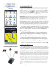
GPS Applications
-8-
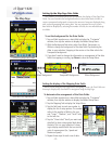
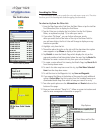
Map Setup
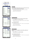
GPS Settings
To set the Maximum Zoom level for Course Line, Bearing Line, Track
Log, Saved Tracks, Lat/Lon Grid and Grid Labels:
1. For Maximum Zoom select from “OFF”, “AUTO”, or an increment
from a scale of 120 feet to 800 miles.
2. Repeat for each listed map feature.
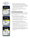
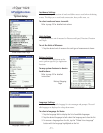
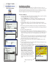
Road Detail Settings
To set the Text Size for Track Logs, Railroads and Street Labels:
1. Tap the Road tab from the Map Setup Pages.
2. Select from “Off”, “Small”, “Medium” and “Large” options for display
of each listed map feature.
To set the Maximum Zoom:
1. For Maximum Zoom select from “OFF”, “AUTO”, or from an incremental
scale of 120 feet to 800 miles.
2. Repeat for each listed map feature.
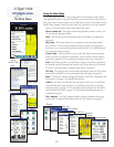
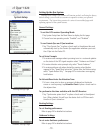
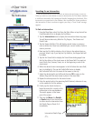
Map Point Settings
To set the Text Size for Waypoints, Interstate Exits, and Points of
Interest:
1. Tap the Point tab from the Map Setup Pages.
2. Select the text size for each type of map item.
To set the Maximum Zoom level:
1. For Maximum Zoom select from “OFF”, “AUTO”, or from an incremental
scale of 120 feet to 800 miles.
2. Repeat for each listed map feature.
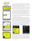
Map Point Settings
Map Road Settings
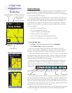
Map GPS Settings