


GNS 530(A) Pilot’s Guide and Reference
190-00181-00 Rev. H
SECTION 3
NAV PAGES
3-17
Inhibit Mode
TERRAIN
has an inhibit mode that deactivates the FLTA/
PDA aural and visual alerts. Pilots should use discretion
when inhibiting
TERRAIN
and always remember to enable
the system when appropriate. For more information, see
Section 12.3,
TERRAIN
alerts.
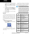
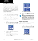
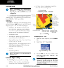
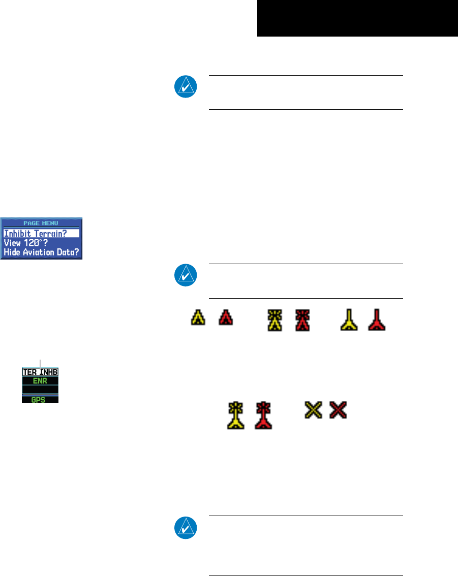
Inhibiting TERRAIN:
1) Select the TERRAIN Page and press the MENU
Key. ‘Inhibit Terrain?’ is selected by default
(Figure 3-31).
Figure 3-31 TERRAIN Page Menu
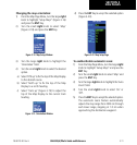
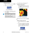
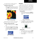
2) Press the ENT Key. The ‘TER INHB’ annunciation
is displayed in the annunciator field when
TERRAIN is inhibited (Figure 3-32).
Annunciator Field
Figure 3-32 TERRAIN Annunciator Field
Enabling TERRAIN:
1) Select the TERRAIN Page and press the MENU
Key. ‘Enable Terrain?’ is selected by default.
2) Press the ENT Key. The TERRAIN system is
functional again.
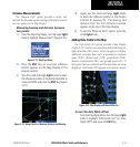
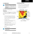
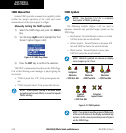
TERRAIN Symbols
NOTE: See Section 12.2 for a complete
description of TERRAIN symbology.
The following symbols (Figure 3-33) are used to
represent obstacles and potential impact points on the
TERRAIN Page.
• Red Symbol - Terrain/Obstacle is above or within
100 feet below the aircraft altitude
• Yellow Symbol - Terrain/Obstacle is between 100
feet and 1000 feet below the aircraft altitude
• Black Symbol - Terrain/Obstacle is more than
1000 feet below the aircraft altitude
NOTE: Obstacle symbols are shown on display
zoom ranges up to 10 nm.
Unlighted
Obstacles
<1000 feet AGL
Lighted
Obstacles
<1000 feet AGL
Unlighted
Obstacles
>1000 feet AGL
Lighted
Obstacles
>1000 feet AGL
Potential
Impact Points
Figure 3-33 TERRAIN Symbols
NOTE: If an obstacle and the projected flight path
of the aircraft intersect, the display automatically
zooms in to the closest potential point of impact
on the TERRAIN Page.