


GNS 530(A) Pilot’s Guide and Reference
190-00181-00 Rev. H
14-18
SECTION 14
ADDITIONAL FEATURES
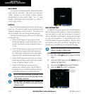
10) Return to the Map Page by pressing the CLR
Key.
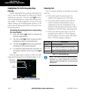
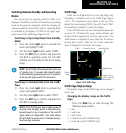
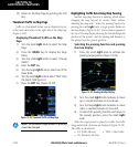
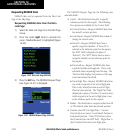
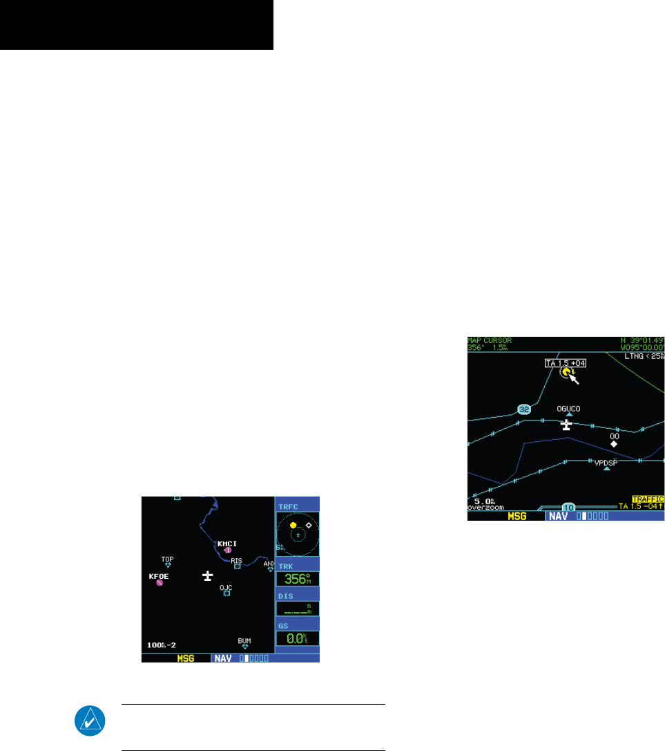
Thumbnail Traffic on Map Page
Traffic in a thumbnail format can be displayed in any
of the three data elds on the right side of the Map Page
(Figure 14-28).
Displaying Thumbnail Traffic on the Map
Page
1) Turn the small right knob to select the Map
Page.
2) Press the MENU Key to display the Page
Menu.
3) Turn the small right knob to select ‘Change
Fields?’.
4) Press the ENT Key.
5) Turn the large right knob to select one of the
three fields.
6) Turn the small right knob to select ‘TRFC’ from
the Select Field Type List.
7) Press the ENT Key. (Figure 14-28)
Figure 14-28 Thumbnail Traffic on Map Page
NOTE: The thumbnail range defaults to 6 nm and
cannot be changed.
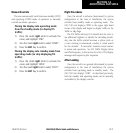
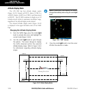
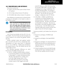
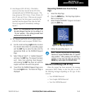
Highlighting Traffic Data Using Map Panning
Another map page function is panning, which allows
changing the map beyond its current limits without
adjusting the map scale. Select the panning function by
pressing the small right knob, a target pointer flashes on
the map display (Figure 14-29). Also a window appears at
the top of the map display showing the latitude/longitude
position of the pointer, and the bearing and distance to
the pointer from the present position.
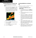
Selecting the panning function and panning
the map display:
1) Press the small right knob to activate the
panning target pointer (Figure 14-29).
Figure 14-29 Panning the Map Display
2) Turn the small right knob clockwise to move
up, or counterclockwise to move down.
3) Turn the large right knob clockwise to move
right, or counterclockwise to move left.
4) To cancel the panning function and return to
the present position, press the small right
knob.
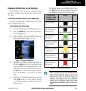
When the target pointer is placed on trafc, the trafc
range and altitude deviation are displayed (Figure 14-29).
The traffic is identified as:
• TA: Trafc Advisory • TRFC: Other Trafc
• PA: Proximity Advisory