


GNS 530(A) Pilot’s Guide and Reference
190-00181-00 Rev. H
8-3
SECTION 8
NRST PAGES
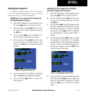
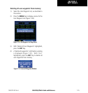
Navigating to a Nearby Waypoint
The NRST pages can be used in conjunction with the
GNS 530’s direct-to function to quickly set a course to a
nearby facility, and can provide navigation to the nearest
airport in case of an in-flight emergency.
Selecting a nearby airport, VOR, NDB,
intersection, or user waypoint as a direct-
to destination:
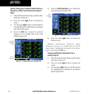
1) Use the flashing cursor to scroll through a NRST
page list (Figure 8-5) and highlight the desired
nearest waypoint, as outlined in Section 8.1.
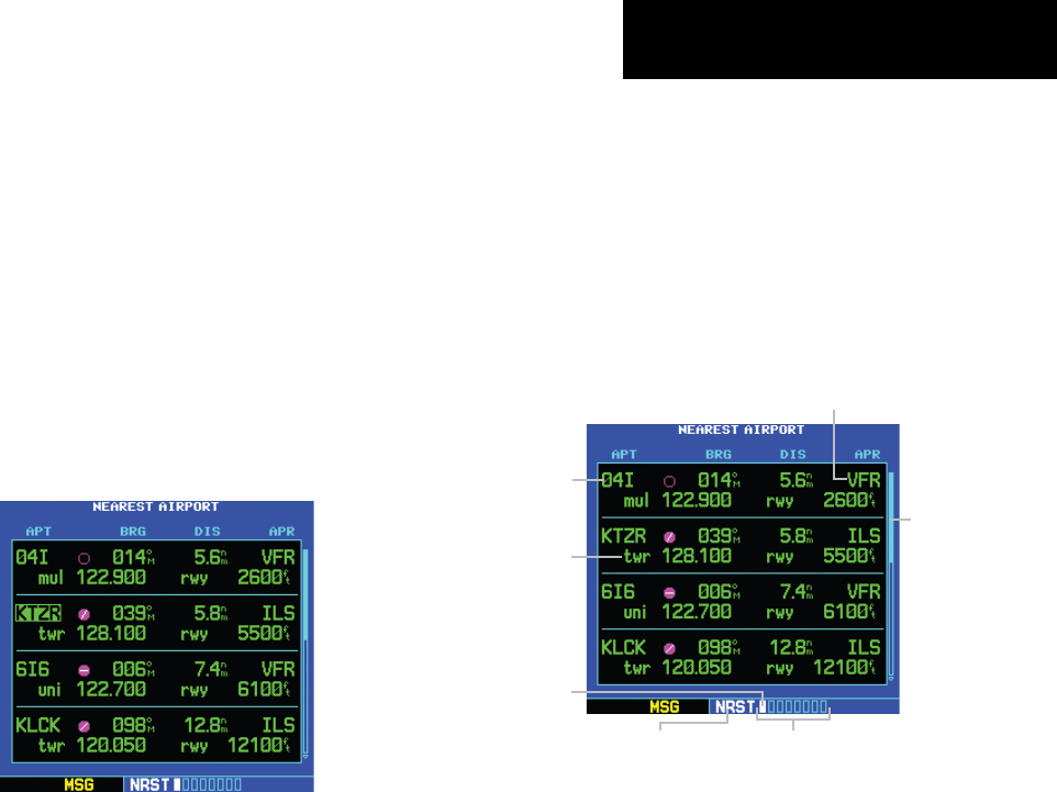
Figure 8-5 Nearest Airport Page
2) Press the Direct-to Key to display the select
Direct-to Waypoint Page.
3) Press the ENT Key to accept the selected
waypoint’s identifier and press the ENT Key
a second time with ‘Activate?’ highlighted to
begin navigating to the selected waypoint.
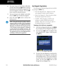
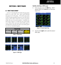
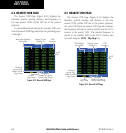
8.2 NEAREST AIRPORT PAGE
The Nearest Airport Page displays the identier, symbol,
bearing, and distance to the nine nearest airports (within
200 nm of the present position). For each airport listed,
the Nearest Airport Page also indicates the best available
approach, common trafc advisory frequency (CTAF),
and the length of the longest runway (Figure 8-6).
Figure 8-6 Nearest Airport Page
Airport Identifier
Symbol, Bearing
To, and Distance To
Tower or CTAF
Frequency and
Longest Runway
Best Available
Approach
Scroll
Bar
Number of Pages in
Current Page Group
Position of
Current Page
within Current
Page Group
Current
Page Group
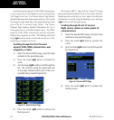
The Nearest Airport Page can be congured to exclude
shorter runways or undesirable runway surface types,
so that the corresponding airports do not appear on the
list. The pilot may wish to use this feature to exclude
seaplane bases or runway lengths which would be difficult
or impossible to land upon. See Section 10.5, Setup Page:
Nearest Airport Criteria for additional details.