


GNS 530(A) Pilot’s Guide and Reference
190-00181-00 Rev. H
14-5
SECTION 14
ADDITIONAL FEATURES
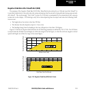
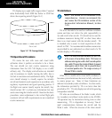
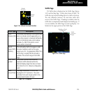
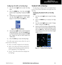
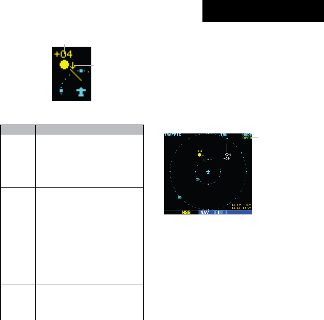
Figure 14-4 Altitude Trend and Deviation
Altitude
Deviation
Altitude
Trend
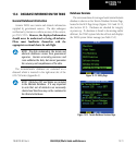
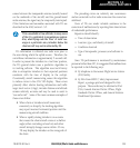
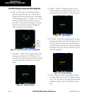
Traffic Type Description
Traffic
Advisory (TA)
This symbol (solid yellow circle) is generated
when an intruder aircraft approaches on a
course that projects to intercept (defined by
a 0.5 nm horizontal radius and a relative
altitude of ± 500 ft) the pilot’s current
course within 34 seconds.
Out-of-
Range Traffic
Advisory
This solid yellow half circle appears under
the same conditions and has the same
urgency as a TA. Its appearance differs from
the TA only to signify that the intruder is
outside of the current range of the Traffic
Page.
Other Traffic
Symbol
This symbol (hollow white diamond)
represents traffic detected within the
selected display range that does not meet
the criteria for a TA. (May be configured as
cyan).
Traffic
Ground Track
The target track vector is a short line
displayed in 45° increments. The vector
protrudes from each target symbol in the
approximate direction of travel.
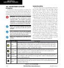
Table 14-2 TIS Options
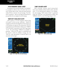
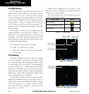
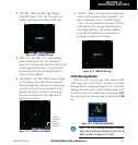
Traffic Page
TIS Traffic data is displayed on the Trafc Page (Figure
14-5) and the Map Page. Unlike other forms of trafc, TIS
traffic does not require heading data to be valid on the map.
The only difference between TIS and other traffic data
occurs on the Trafc Page. If heading is available, then the
traffic data is compensated and displayed as heading-up. If
it is not available, the Trafc Page is a track-up display. It is
labeled on the upper portion of the Trafc Page.
Figure 14-5 Traffic Page
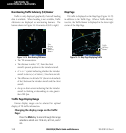
Mode
Selection
Field
Heading or Track
Up Indicator