


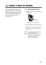
12. USING C-MAP NT MODEL
12-6
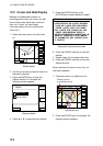
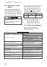
12.5 Setting Chart Setup
Options
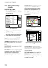
CHART DETAILS menu
1. Press the [MENU] key followed by the
CHART SETUP OPTIONS and CHART
DETAILS soft key.
DGPS 3D
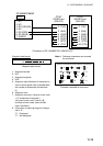
CHART
DETAIL
RETURN
EDIT
DEPTH
INFO
LAT/LON GRID
TEXT INFO
WAYPOINT
WAYPOINT NAME
INDEX
LANDMASS
BACKGROUND
NAV AIDS
SECTOR INFO
OTHER SYMBOLS
MARK SIZE
GREEN
ON
LARGE
ON
ON
BRT YELLOW
BLUE
ON
ON
WHITE
STD
Chart details menu
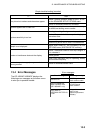
2. Press ▲ or ▼ to select item and press
the EDIT soft key.
3. Select option with cursor pad and press
the ENTER soft key or the [ENTER] key.
4. Press the RETURN soft key to finish.
Items which are concerned with C-MAP
NT-FP chart cards are described here.
LANDMASS: Selects brightness and color of
land. When you select OFF, color of land is
black.
BACKGROUND: Not available with C-MAP
NT-FP chart card.
NAV AIDS: Turns aids to navigation symbols
(for example, buoys) on/off. When OFF is
selected, symbols are displayed but
information is not displayed (at the upper
part of the screen).
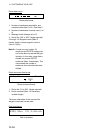
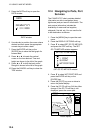
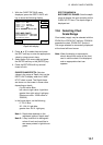
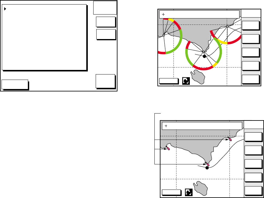
SECTOR INFO: Turns lighthouse viewable
angle indication on C-MAP NT-FP chart
on/off. Viewing angle is shown as an arc
extending from lighthouse position. This
feature is available with selected charts.
When OFF is selected, the visual information
is not displayed and the lighthouse is
displayed as "!".
DGPS 3D
CENTER
GO TO
CURSOR
COURSE
UP
ZOOM
OUT
ZOOM
IN
NORTH
UP
135° 12.345' E
34° 12.345' N
OS
FROM
276.9°
16.45nm
Sector info
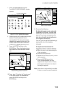
DGPS 3D
CENTER
GO TO
CURSOR
COURSE
UP
ZOOM
OUT
ZOOM
IN
NORTH
UP
135° 12.345' E
34° 12.345' N
OS
FROM
276.9°
16.45nm
Lighthouse
Lighthouse appearance when sector info
is off
OTHER SYMBOLS: Selects color of all
other chart symbols. When OFF is selected,
navaid icons are not displayed but alarm
icons are displayed.
DEPTH INFO soft key: Turns the DEPTH
INFO display on/off and sets it color on
FURUNO charts, or selects the depth areas
limit and spot sounding & bathymetric range
in C-MAP NT-FP chart.