


vi
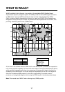
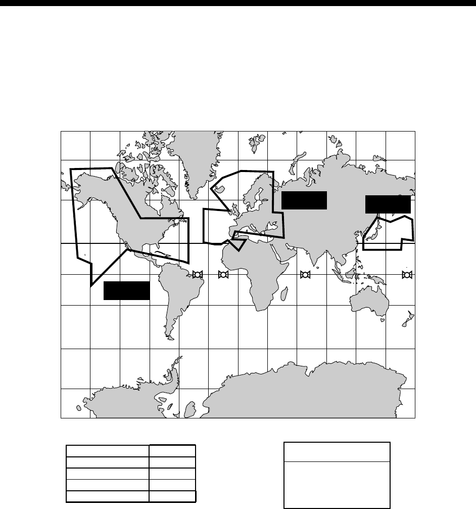
WHAT IS WAAS?
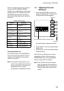
WAAS, available in North America, is a provider in the worldwide SBAS (Satellite Based
Augmentation System) navigation system. An SBAS provider furnishes GPS signal corrections
to SBAS users. Two more SBAS providers are also currently under development, MSAS
(Multi-Functional Satellite Augmentation System) for Japan and EGNOS (Euro Geostationary
Navigation Overlay Service) for Europe. All providers will be compatible with one another, thus
providing “seamless” position fixes to SBAS users.
150°W 120°W 90°W 60°W 30°W 0 30°E 60°E 90°E 120°E 150°E
150°W 120°W 90°W 60°W 30°W 0 30°E 60°E 90°E 120°E 150°E
0
20
°S
40
°S
60
°S
20
°N
40
°N
60
°N
0
20
°S
40
°S
60
°S
20
°N
40
°N
60
°N
WAAS
EGNOS
MSAS
Satellite, Region Position
120, AOR-E
15.5°W
122, AOR-W
54°W
131, IOR
64.5°E
134, POR
178°E
131
134
122
120
Initial operation time
WAAS: 2003
EGNOS: 2004
MSAS: 2005
At the time of this software release, SBAS is still under development. (Providers are expected to
have initial operations capability from the times shown above.) During this developmental period,
which may last for several years, there is no guarantee of the accuracy, integrity, continuity, or
availability of the SBAS signal. Furuno will accept no responsibility for the use of the signal for
other than the above stated purpose. It is the user’s responsibility to exercise common
prudence and navigational judgment while using the SBAS signal in the developmental phase.
Note: This manual uses “WAAS” when referring to any SBAS provider.