


12. USING C-MAP NT MODEL
12-2
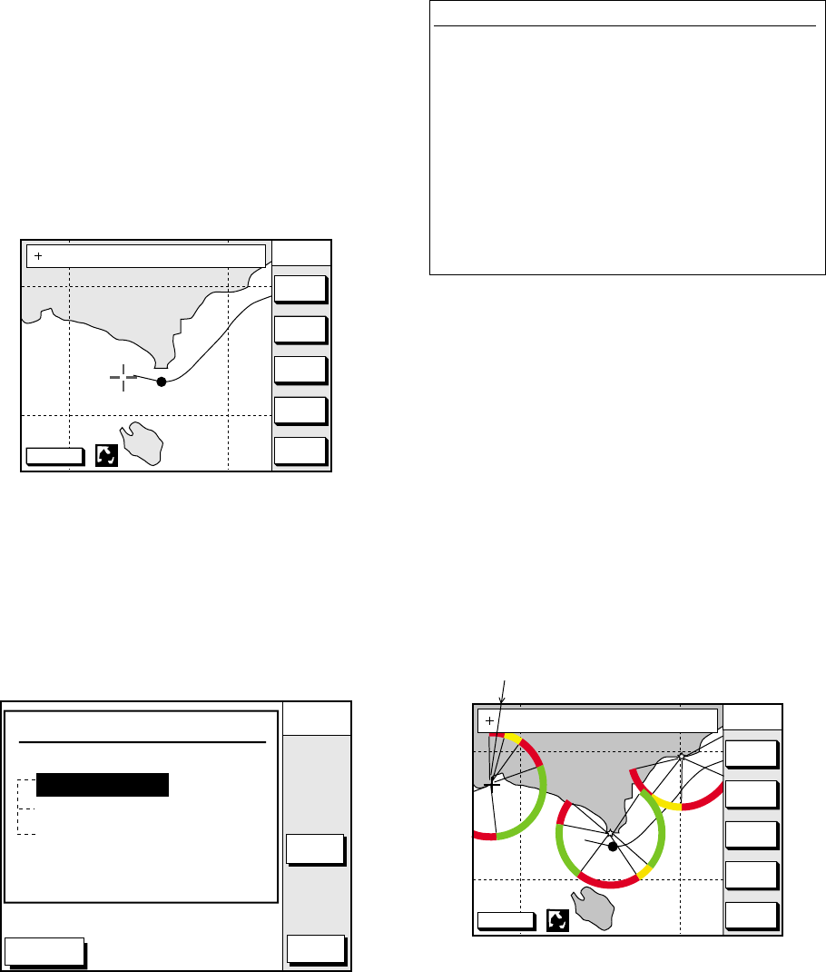
12.2 Cursor and Data Display
Besides its fundamental functions of
providing position data, the cursor can also
show caution area, depth area, source of
data, etc. Further, you can display
information about an icon by placing the
cursor on it.
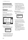
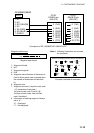
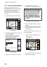
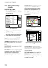
1. Press the cursor pad to turn the cursor
on.
DGPS 3D
CENTER
GO TO
CURSOR
COURSE
UP
ZOOM
OUT
ZOOM
IN
NORTH
UP
135° 12.345' E
34° 12.345' N
OS
FROM
276.9°
16.45nm
Plotter display
2. Use the cursor pad to place the cursor on
the position desired.
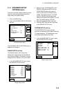
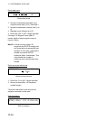
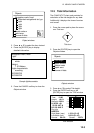
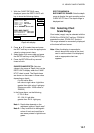
3. Press the [ENTER] key to open the
Objects window. For example the
following window appears.
DGPS 3D
CANCEL
ENTER
PORT
SERVICE
PUNTA CORNACCHIA
ACCO AMENO
ISCHIA PORTO
Objects
Depth area
Source of data
Caution area
Objects window
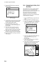
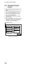
4. Press ▲ or ▼ to select the item desired.
5. Press the ENTER soft key or the
[ENTER] key to display details for object.
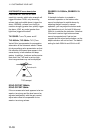
Caution area
Information
LEUCHTFEUER DIE KARTE ENTHAEL
T NUR DIE LAGEN DER WICHTIGEN
FEUER. LIGHTS ONLY THE PRINC
IPAL LIGHTS ARE SHOWN ON THIS
CHART. MISSWEISUNG SIEHE K
ARTEN GROESSEREN MASSSTABS. M
AGNETIC VARIATION LOCAL MAGNE
TIC ANOMALIES SEE LARGER SCAL
E CHARTS.
Example of caution area window
6. Press the CANCEL soft key to close the
window.
7. Repeat steps 4 to 6 to select other item.
8. Press the CANCEL soft key to close the
Objects window.
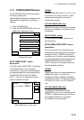
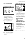
When you place the cursor on any icon, its
information appears.
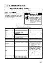
1. Place the cursor on a lighthouse icon.
DGPS 3D
CENTER
GO TO
CURSOR
COURSE
UP
ZOOM
OUT
ZOOM
IN
NORTH
UP
NAVAID : X X X X X X 6S 7m 9M
FROM OS 2. 43nm 351. 2°
Place the cursor
on a lighthouse icon.
Lighthouse icon
2. Press the [ENTER] key. For example, the
following window appears.