


12. USING C-MAP NT MODEL
12-4
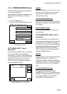
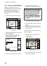
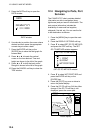
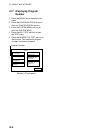
5. Press the DATE soft key to open the
DATE window.
DATE
DD/MM/YYYY
01 / 01 / 2000
DATE window
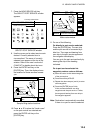
6. Use ◄ or ► to position the cursor where
desired and then press the appropriate
numeric keys to enter a date.
7. Press the ENTER soft key or the
[ENTER] key to show the tidal graph for
entered date.
8. Press ◄ or ► to locate the vertical
cursor on the time desired. Time and
height are shown to the left of the graph.
9. Press ▲ or ▼ to shift the level cursor.
Draught is shown to the left of the graph.
10. Press the CANCEL soft key to close the
TIDE window.
12.4 Navigating to Ports, Port
Services
The C-MAP NT-FP chart provides detailed
information on aids to navigation (buoy,
lighthouse) and port service information. The
port service information includes the
availability of water and fuel supplies,
shipyards, first aid, etc. You can use the list
to set destination as follows:
1. Press the [MENU] key to open the main
menu.
2. Press the DISPLAY OPTIONS soft key.
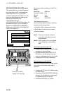
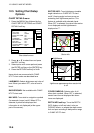
3. Press ▼ to select SET GO TO METHOD
and press the EDIT soft key. The SET
GO TO METHOD window appears.
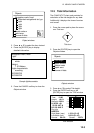
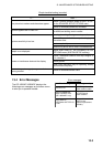
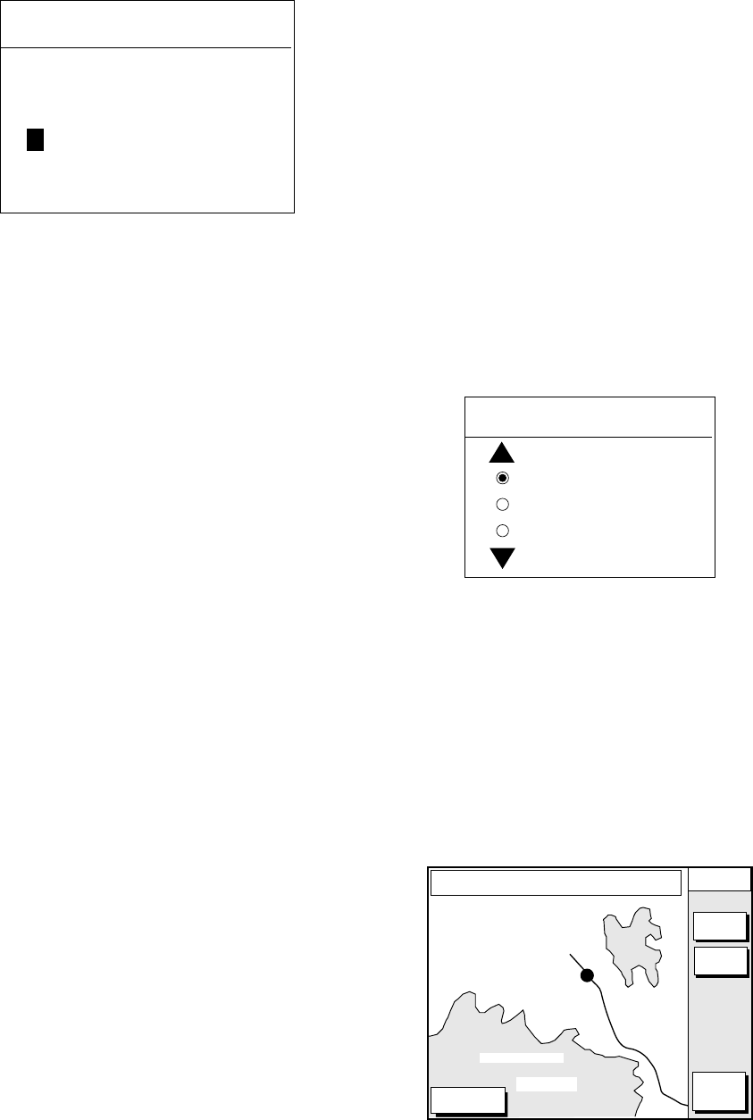
SET GO TO METHOD
1 POINT
35 POINT
WPT/PORT SER
SET GO TO METHOD window
4. Press ▼ to select WPT/PORT SER and
press the ENTER soft key or the
[ENTER] key.
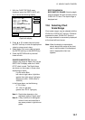
5. Press the [PLOT] key once or twice to
return the plotter display.
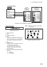
6. Press the GO TO soft key. Soft key titles
change. If the GO TO soft key is not
displayed, press the cursor pad.
DGPS 3D
CANCEL
GO TO
FROM
OS
0.26 nm
180.2˚
QUICK
ROUTE
NEAR
SRVICE
GO TO
PUNTA CORNACCHIA
ACCO AMENO
I. ISCHIA
CASAMICCIOLA
ISCHIA PORTO
40˚45.971'N
13˚57.462'E
+
Plotter display