


2. PLOTTER OPERATION
2-14
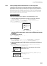
2.5.4 C-MAP charts
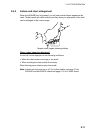
Cursor and data display
Besides its fundamental functions of providing position data, the cursor can also
show information about caution area, depth area, source of data, etc. on C-MAP
charts. In addition, you can display information about an icon by placing the
cursor on it.
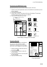
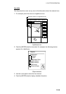
1. Press the cursor pad to turn the cursor on.
2. Use the cursor pad to place the cursor on the position desired.
3. Push the [ENTER] knob to open the Objects window.
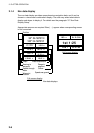
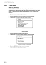
Objects
Spot Sounding
Depth area
Exclusive economic zone
Military practice area
Restricted area
Source of data
Objects window
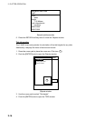
4. Use the cursor pad to select the item desired.
5. Push the [ENTER] knob to display details for object selected.
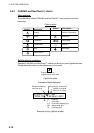
Depth area
Depth range value1
0.00 Meters
Depth range value2
1829.00 Meters
Example of caution area window
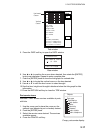
6. Press the RETURN soft key to close the window.
7. Press the [MENU] key to close the menu.