


27
••••••••••••••••••••••••••••••••••••••••••••••••••••••••••••••••••••••••••••••••
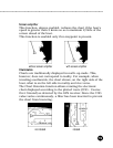
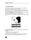
Route
ROUTE
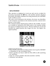
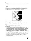
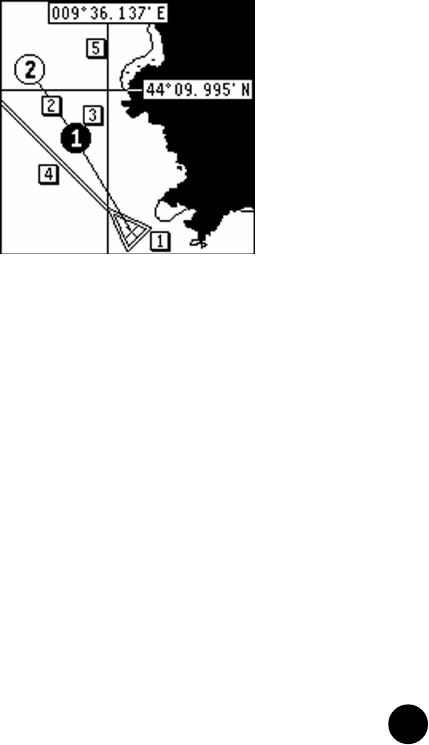
The GEONAV can manage navigation along a planned route.
The figure shows a route displayed by the GEONAV.
1 - Boat’s position
The boat’s position is displayed according to the data
received from the GPS receiver.
2 - Leg
Route segment between 2 waypoints.
3 - Waypoint
The waypoint is identified by a circle and a number. The
GEONAV will display the “Proximity to Waypoint” message
to warn the user that in about 25 seconds he is about to
approach the next target waypoint. The message “End of
Trip” is displayed when the user is about to reach the last
waypoint of the route.
The first waypoint is identified by the symbol “X”. The
target waypoint (the next point the boat is navigating to) is
identified by a black circle with the relevant number
shown in reverse.