


22
•••••••••••••••••••••••••••••••••••••••••••••••••
Navigation Window
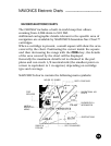
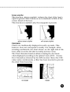
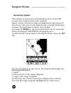
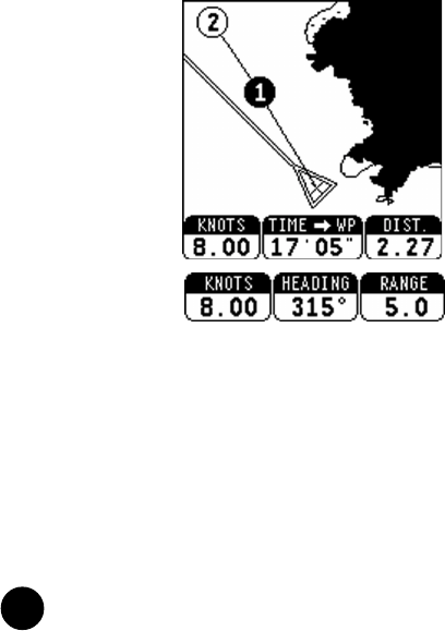
NAVIGATION WINDOW
This window is activated automatically as soon as the GPS
receiver has computed the boat’s position.
Speed, course and chart range are displayed at the bottom of
the screen. The screen scale indicates the rounded off distance
between the instrument’s center and top side.
By using the ZOOM key, the chart detail level can be increased,
thus accessing the NAVIONICS cartography data.
To switch from Cursor mode to Navigation mode, press the CLR
key.
If a route is plotted on the screen, the window will display the
following information:
• speed
• time to arrive to the target waypoint
• range to the target waypoint
In this case, the current route leg is displayed by a thicker
line and the target waypoint highlighted by a dark circle.