


16
••••••••••••••••••••••••••••••••••••••••••••
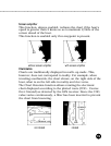
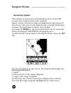
To increase the map detail, press ZOOM+.
To decrease the map detail, press ZOOM-.
How to display bathymetric lines
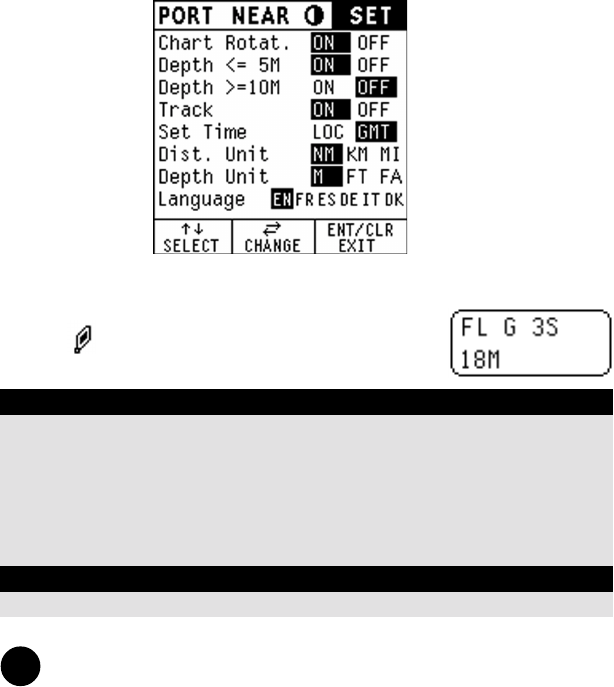
Enter the Navigation mode (see next chapter), then press ENT
until the menu bar is displayed, select SET, then enable the
options desired using the CURSOR key.
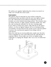
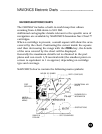
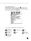
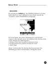
How to display navaids
Positioning the manual cursor on the navaid
symbol , a window will display the relevant
characteristic.
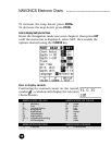
NAVIONICS Electronic Charts
ABBREVIATIONS FOR LIGHT ABBREVIATIONS FOR COLOUR
AL alternating AM amber
F fixed B black
FLL fixed and flashing BL blue
FL (...) group flashing G green
FL single flashing OR orange
IQ interrupted quick R red
OC single-occulting VL violet
OC (...) composite group occulting W white
Q continuous group Y yellow
ABBREVIATIONS FOR PERIOD ABBREVIATIONS FOR RANGE
..S xx seconds ..M xx nautical miles