


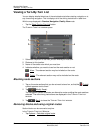
Working With Maps
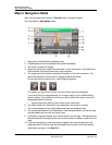
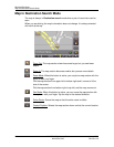
Map in Navigation Mode
62 NAVIGON 7100 User’s Guide January 2008
NAVIGON, INC. Revision 2.0
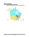
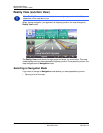
Map in Navigation Mode
After the route has been viewed in Preview mode, navigation begins.
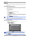
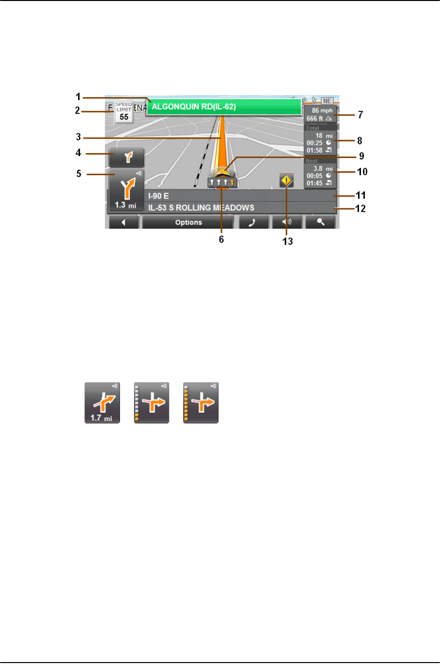
The map opens in Navigation mode.
1. Sign posts to be followed is displayed here.
2. Posted speed limits are displayed here (where available).
3. The route is marked in orange.
4. When two maneuvers need to be executed in quick succession, the small arrow
field indicates the second maneuver to be executed.
5. The large arrow field shows a simplified illustration of the next maneuver. The
remaining distance to the junction is displayed below the arrow.
As you get closer to the junction, a spot diagram appears.
The nearer you get to the junction, the more yellow spots are displayed.
If you don't have to change direction for a longer period, only a forward facing
arrow is shown. The distance for which you are to follow the road you are on is
displayed beneath the arrow.
• Tap the large arrow field to hear current route instructions.
6. The traffic lanes to be followed to your destination are shown in orange
7. The current speed and the height above sea level are displayed here.
8. The remaining distance to the destination, the estimated duration of the trip, and
the estimated time of arrival are shown here.
9. A triangle in orange indicates your current position on the map. The map area dis-
played continually changes so that your current position is always centered on the
map.
10. If you are navigating a route with several stages, the remaining distance, esti-
mated duration of the trip, and the estimated time of arrival for the next interim
destination is shown in the Next field.