


36
Plotter
Trail
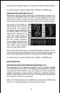
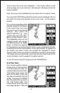
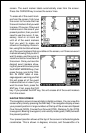
time to move the cursor lines diagonally. In the screen shown on the
previous page, the cursor lines are 1.08 miles and 149 degrees from the
present position.
Note: The cursor is not available when the map is in the “course up” mode.
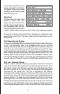
If you press the CENTER key while the cursor lines are displayed, the unit
will center the map at the position of the cursor lines - not the present
position.
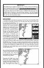
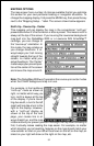
If you want the GlobalMap 2000
to show navigation information
to the cursor lines, first move
the cursor lines to the desired
location, then press the
WAYPT/ROUTE key. Now
press the key next to the “Navi-
gate to Cursor Position” label.
The GlobalMap returns to the
mapping screen with naviga-
tion data showing in the digital
boxes. A dotted line appears
on the map from your present position to the cursor, showing the shortest,
most direct line to the cursor position. A box with the letter “S” appears at
the location you were in when you pressed the “Navigate to Cursor
Position” label. The cursor position is marked by a small box and the letters
“XX” which remain on the screen, even if you turn the cursor lines off. For
more information, see the waypoint navigation section.
To turn the cursor lines off, simply press the CURSOR key.
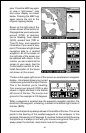
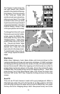
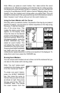
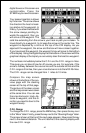
PLOTTER TRAIL
Your present position marker
leaves a line or “trail” behind as
it moves across the map, ac-
cording to the boat’s movement.
This makes it easy to see the
path you’ve taken. There are
two ways to customize the trail
plotter. First press the MENU
key. Now press the key next to
the “Trail Plotter” label. The
screen shown at the top of the
next page appears. There are