


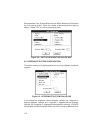
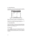
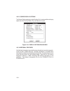
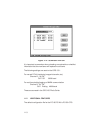

10.2.3 CONFIG DISPLAY OPTIONS
The Display Options dialog box (see Section 9.4) includes additional display
options to show Facility Name, City and State on the plot.
Figure 10-4: DISPLAY OPTIONS DIALOG BOX
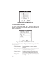
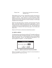
10.3 ADDITIONAL FEATURES
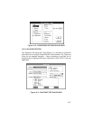
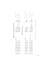
Valid altitude information is provided for airport locations in proximity waypoint,
route and plot (.GRM) data files. Altitude information is included when
downloading, uploading, and editing these data files. Example waypoint and
route files are shown on the following page. Note that for non-airport
waypoints, altitude is “-9999” indicating valid altitude information is not
available. The default configuration file for the PCX5AVD PC-Kit is
PCX5AVD.CFG.
10-4