


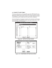
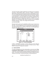
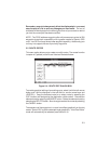
The DXF Conversion Options dialog box will prompt you for conversion
parameters. Select between “Metric”, “Nautical” or “Statute” to indicate the
type of units into which you wish the data converted. Select between “Points”
or “Lines” to designate whether the data shall be converted as discrete points
or connected by lines. Indicate the waypoint text to be converted: identifier
and/or descriptions. Enter the height for text characters expressed as the
percentage of the vertical extent of the current plot. The default is 3%. The
2D option eliminates the altitude data (some GPS units do not support
altitude) for a 2-dimensional DXF export to programs such as Microsoft
Word® for Windows. Select “OK” to begin the file conversion.
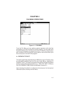
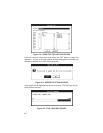
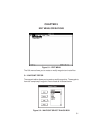
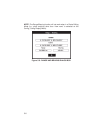
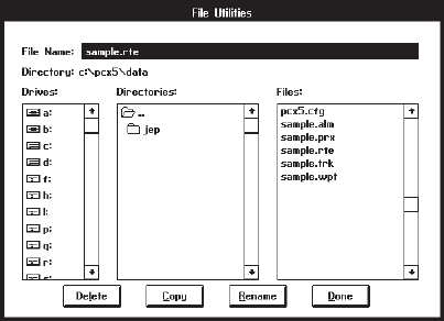
4.6 FILE UTILITIES
This menu option gives you the capability to delete, copy or rename your
DOS files. To use this option, fill in the file information (drive, directory and
file name). Select the DELETE button to delete the file; the COPY button to
copy the file to another drive, directory or file name; or the RENAME button
to give the file a different name.
Figure 4.11: FILE UTILITIES BOX
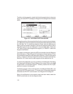
If COPY or RENAME is selected, a second dialog box will be displayed
prompting for the Copy Destination file name or the New file name. Select
DONE to indicate file changes are complete.
4.7 PRINT SCREEN
This option allows you to print the contents of the current screen plot. Prior
to running the PCX5 program, from the DOS prompt, execute the DOS
“GRAPHICS” command with the proper parameters and designation for your
printer. For example, the following command line sets up a Hewlett-Packard
LaserJet II for printing in reverse mode (black w/ white background):
GRAPHICS LASERJETII /R
4-6