


· COORDINATE SYSTEM =coordinate system configuration (text string)
· SOFTWARE NAME & VERSION (text string)
· R = Altitude Reference (E=Ellipsoid or G=Geoid)
· DATUM = map datum used (text string)
· IDNT = Identifier (text string)
· IDX = Datum index
· DA = Delta earth radius
· DF = Delta flattening factor
· DX, DY, DZ = Delta earth center
· DESCRIPTION = Waypoint description
· PROXIMITY = Proximity distance
An example of each record type is given in the sections that follow. Note that
the time given in the points created by the unit is UTC Time; points created
by the PC are in local PC Time.
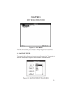
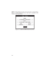
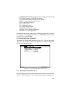
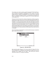
6.2 DOWNLOAD DATA FROM UNIT
This option will transfer data from the unit into a PC. From the sub-menu
select the type of data to download: Waypoints, Proximity Waypoints,
Routes, Track log or Almanac.
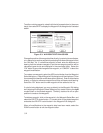
Figure 6-2: DOWNLOAD DATA OPTIONS
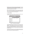
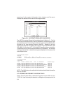
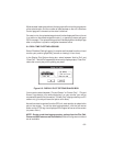
6.2.1 DOWNLOAD WAYPOINT DATA
Select “Waypoint Data” to download waypoints from the GPS unit to an ASCII
file with a “.WPT” extension. Upon choosing this selection, a dialog box will
6-3