


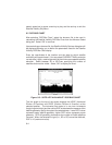
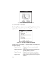

Next, choose between indicating latitude and longitude as North/South/East/
West (“NS/EW”) or positive/negative (“+/-”). (NOTE: Positive latitude is
North and positive longitude is East.)
Enter the number of decimal precision digits that will be displayed for position
coordinates. Select “OK” to confirm the coordinate system selection.
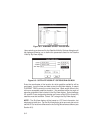
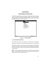
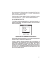
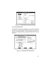
9.3 DATUM CONFIGURATION
The “Datum” selection is used to define the map datum from which all
positions are calculated. Upon selecting this option, the dialog box shown
below will be displayed.
Figure 9-4: DATUM CONFIGURATION DIALOG BOX
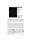
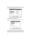
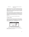
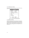
Scroll through the list of map datums by left clicking the mouse pointer on the
up/down arrows (on the right side of the datum list).
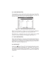
If USER is selected, the User Datum dialog box will be displayed, as
illustrated below. Enter the parameters defining the differences between the
WGS 84 earth model and the local datum’s earth model. DX, DY and DZ
represent the differences in earth center; DA represents the difference in
semi-major axis; DF represents the difference in flattening factor multiplied
by 10,000 (1x10
4
). The sign of these data should follow the convention: WGS
84 minus local geodetic system.
9-3