GPSMAP 2106/2110 Owner’s Manual 67
MAIN MENU > MAP TAB
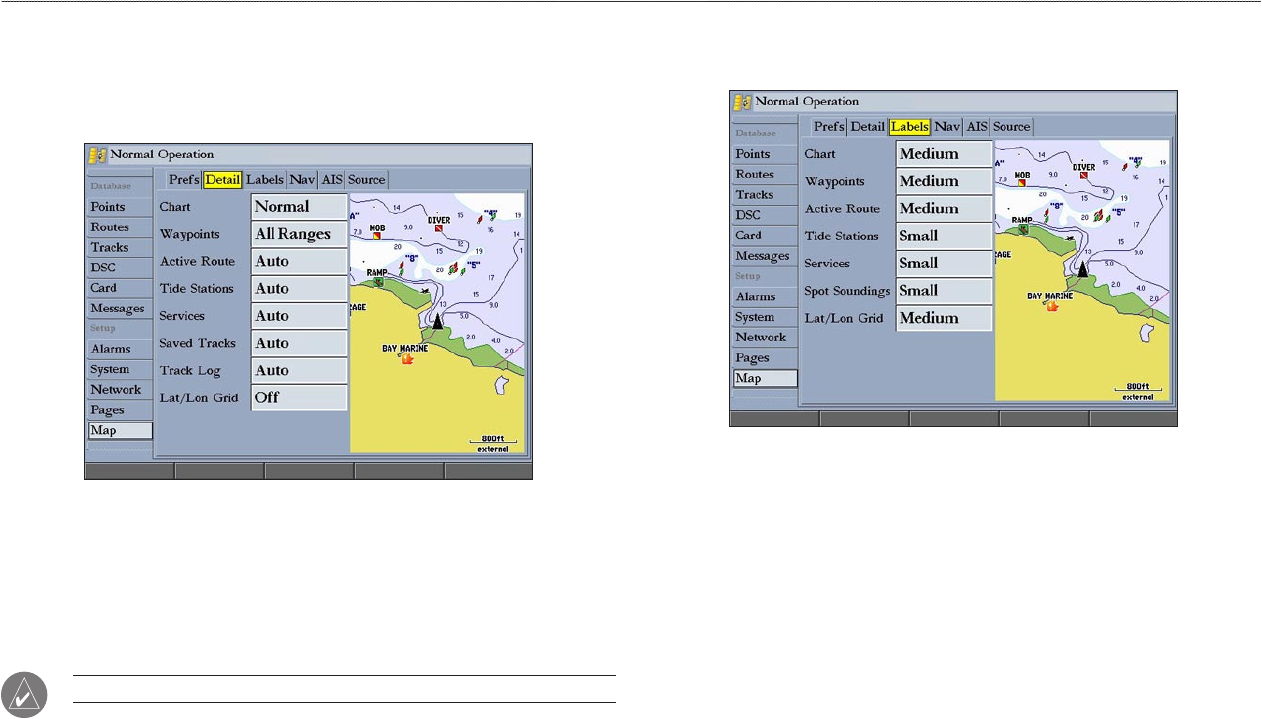
Detail Sub Tab
Use the Detail sub tab to control the amount of detail for charts, waypoints, active
routes, Tide Stations, services, saved tracks, and track logs shown on the Map
Page.
• Chart—controls how much map detail you see and which charts the unit
chooses to use for a particular zoom range. Select Most, More, Normal,
Less, or Least.
• Chart
, Waypoints, Active Route, Tide Stations, Services, Lat/Lon
Grid—sets the maximum scale at which the feature should appear on-
screen. Select Off, All Ranges, Auto, or <30 ft to <800 nm.
NOTE: Some types of data only show up to certain zoom scales.
Labels Sub Tab
Use the Labels sub tab to select the screen size of the text for a given map item.
Chart, Waypoints, Active Route, Tide Stations, Services, Spot Soundings,
Lat/Lon Grid—controls the screen size of the text for a given map item. Select
None, Small, Medium, or Large.


