62
MapSource City Navigator
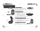
A CD-ROM containing MapSource City Navigator mapping software is included with your
StreetPilot III. City Navigator is designed specifi cally for the StreetPilot III and contains detailed street
maps and points of interest for major cities. This mapping software allows for automatic routing; the
map data also contains turn restrictions and other routing information. With City Navigator data in
your StreetPilot III, simply enter an address or intersection, or search for a point of interest using the
FIND key, and the StreetPilot III will automatically plan a route and provide turn-by-turn directions
to that location. You may also view the address, phone number and map location of services or points
of interest. Be aware that, depending on the City Navigator version, not all areas are covered in detail
by the City Navigator CD. To get detailed, street-level routing for major cities, you need to download
maps from the City Navigator CD.
Additional MapSource Products
Additional City Navigator coverage areas are also available for using the StreetPilot III in many
other parts of the world. When outside major metropolitan areas covered by City Navigator, signifi -
cantly less road detail is included, but it is typically suffi cient to navigate from city to city along major
roads. MapSource MetroGuide, which is available for purchase separately, also works well with the
StreetPilot III. Like City Navigator, MetroGuide offers automatic routing and turn-by-turn navigation.
MetroGuide provides road details and basic routing information, but is not limited to large metropoli-
tan areas. When traveling outside the metropolitan areas covered by City Navigator, you may want to
use MetroGuide for more complete roadway and routing coverage. Depending on your location, you
may fi nd that one CD provides better coverage and better automatic routing capability than the other.
Note that if you are using City Navigator version 4.01 or above, you no longer need to use MapSource
MetroGuide in order to get more detailed routing, when traveling outside of large metropolitan areas.
The StreetPilot III is also compatible with MapSource Roads & Recreation, WorldMap, and Topo,
but with these products installed, the unit will not provide detailed automatic routing. If you’re using
StreetPilot III without downloaded maps from the City Navigator CD, you will still have automatic
routing capabilities along major streets and highways contained in the built-in “basemap”.
Appendix G
Using MapSource
and Data Cards
NOTE: When data from both City Navigator and
MetroGuide (or any other MapSource product) is loaded
for the same area, City Navigator data takes precedence.
You may override this priority scheme by telling your
StreetPilot III which map information to use (see page
41).
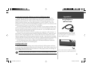
The MapSource City Navigator CD is designed
specifi cally for use with the StreetPilot III, and contains
detailed street maps for major cities within a regional
area (for example, North America or Europe).
190-00256-10_0B.indd 62 1/13/2003, 10:34:28 AM


