


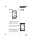

1
Setup,
Features,
and
Basic Navigation
SECTION 2
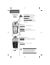
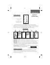
Before you begin to explore the eTrex Legend’s
operating features, you will want to follow these “Getting
Started” instructions to prepare it for operation by
installing batteries, adjusting the screen contrast, loading
optional GARMIN MapSource
TM
mapping data, and set-
ting the correct time for your current location.
The operating features of the unit are structured to
be accessed and activated by pressing buttons on the unit
which is explained on the following page.
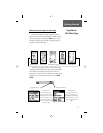
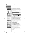
The fi ve Main Pages are your primary access to
operating the eTrex Legend. Each page provides either
a basic navigation function or access to features which
enhance navigation or customize the unit’s operation to
meet your requirements.
This “Getting Started” section will introduce you to
the Main Pages and how they are structured. You will also
be shown how to perform basic navigation techniques to
help you start using your eTrex Legend immediately.
Detailed instructions on using the eTrex Legend’s
features and their options are contained in the “Reference”
section.
Features include:
Storage for 500 Waypoints with name and graphic symbol.
An automatic Track Log with storage capability for 10
Tracks with 250 points each.
Route building capability, with storage for 20 Routes with
50 Waypoints each.
A Trip Computer for displaying a variety of navigation
data such as speed, ETA, ETE, heading, odometer, etc.
A
Find Feature for locating Waypoints, Cities, Interstate
Exits, Points of Interest, Street Addresses and Intersections.
8 MB of detailed map data storage, allowing transfer from
GARMIN MapSource CD-ROM’s.*
Wide Area Augmentation System (WAAS) capability.**
Getting Started
* Points of Interest, Address,
and Intersection data must
be transferred to the unit
using a GARMIN MapSource
CD-ROM. See pages 4 and 55
for more information.
** About WAAS
Because the Wide Area Aug-
mentation System (WAAS) is
currently under development
and is not fully supported by
geo-stationary satellites, effec-
tive use of the WAAS feature
may be limited by your geo-
graphic location in relation to
those satellites now in service.
There are two WAAS satellites
in service in geo-stationary
orbit above the Equator, one
over the Atlantic Ocean and
one over the Pacifi c Ocean.
Currently, WAAS satellite signal
reception requires an absolute
clear view of the sky and works
best when there are no nearby
obstructions such as buildings,
mountains, etc. In fact, you may
not be able to receive or easily
maintain a WAAS satellite signal
until full satellite support for this
program is complete.
Not enabling WAAS when you
cannot receive a signal will
speed unit map drawing and
conserve battery power.
See page 49 for enabling WAAS
and satellite reception
techniques.